Waterfalls around Castle Rock State Park and the Skyline Blvd ridge
The area near Skyline Blvd (route 35) from route 17 in Los Gatos northwest to route 92.
Castle Rock State Park
Kings Creek
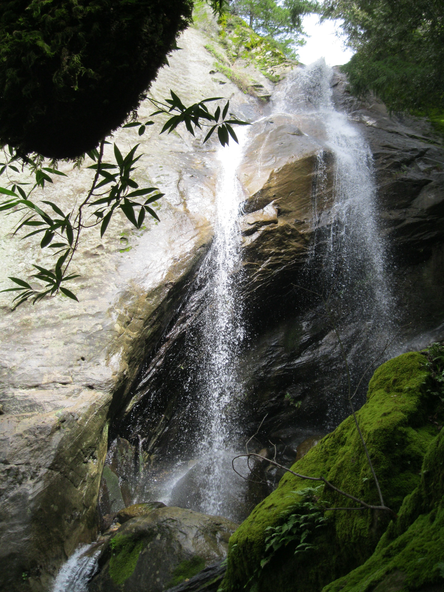
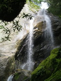
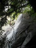
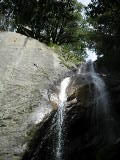
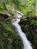
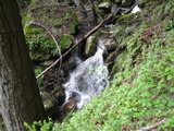
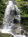
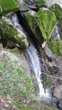
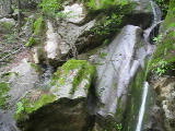
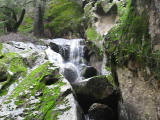
- waterfall at (37.22572, -122.10531):
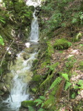
Name: Castle Rock Falls
Poor gps reception - coordinates may be unreliable
taken 2011-03-22:

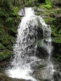
lower half:
Videos:
It has some water year round, but isn't very impressive during the dry season.
Beauty: 9
Duration: 365 days after a significant rainfall
Height 76 feet give or take 8 feet
Biggest vertical drop 30 feet
Number of drops 2
Terrain: well-maintained trail
For more info, see California Waterfalls, by Ann Marie Brown
http://www.bahiker.com/southbayhikes/castlerock.html
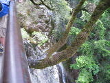
route: From the main entrance to the park, follow the Saratoga Gap Trail to an obvious platform sticking out over the top of the cliff. If you want to view it from the bottom, there are unmarked trails used by rock climbers to the east. The best way to reach the falls on these trails starts quite a ways from the falls. I probably won't be more specific because I don't want too many people using the unofficial trails.
Last visited 2011-03-22
id: skyline.1
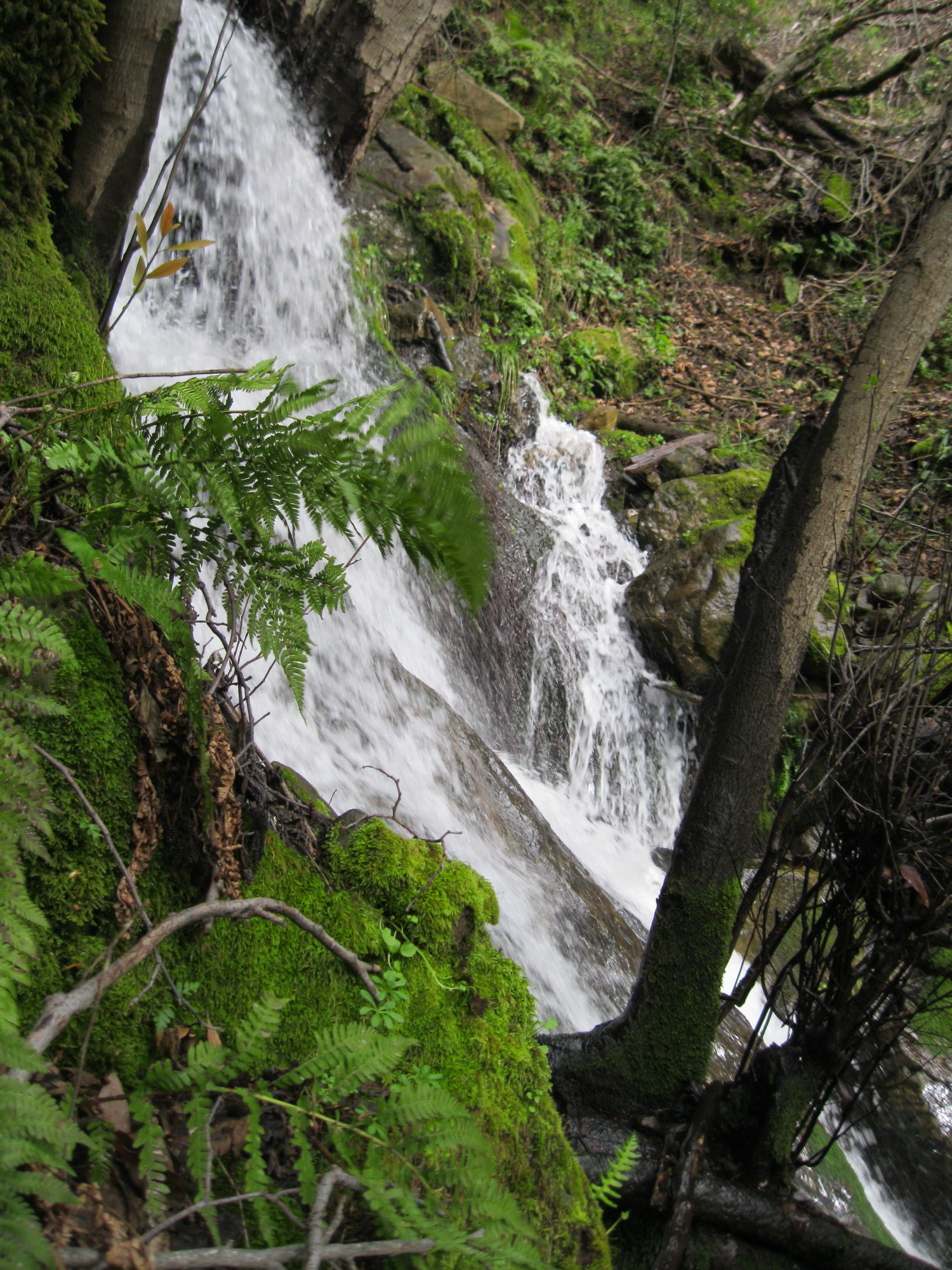
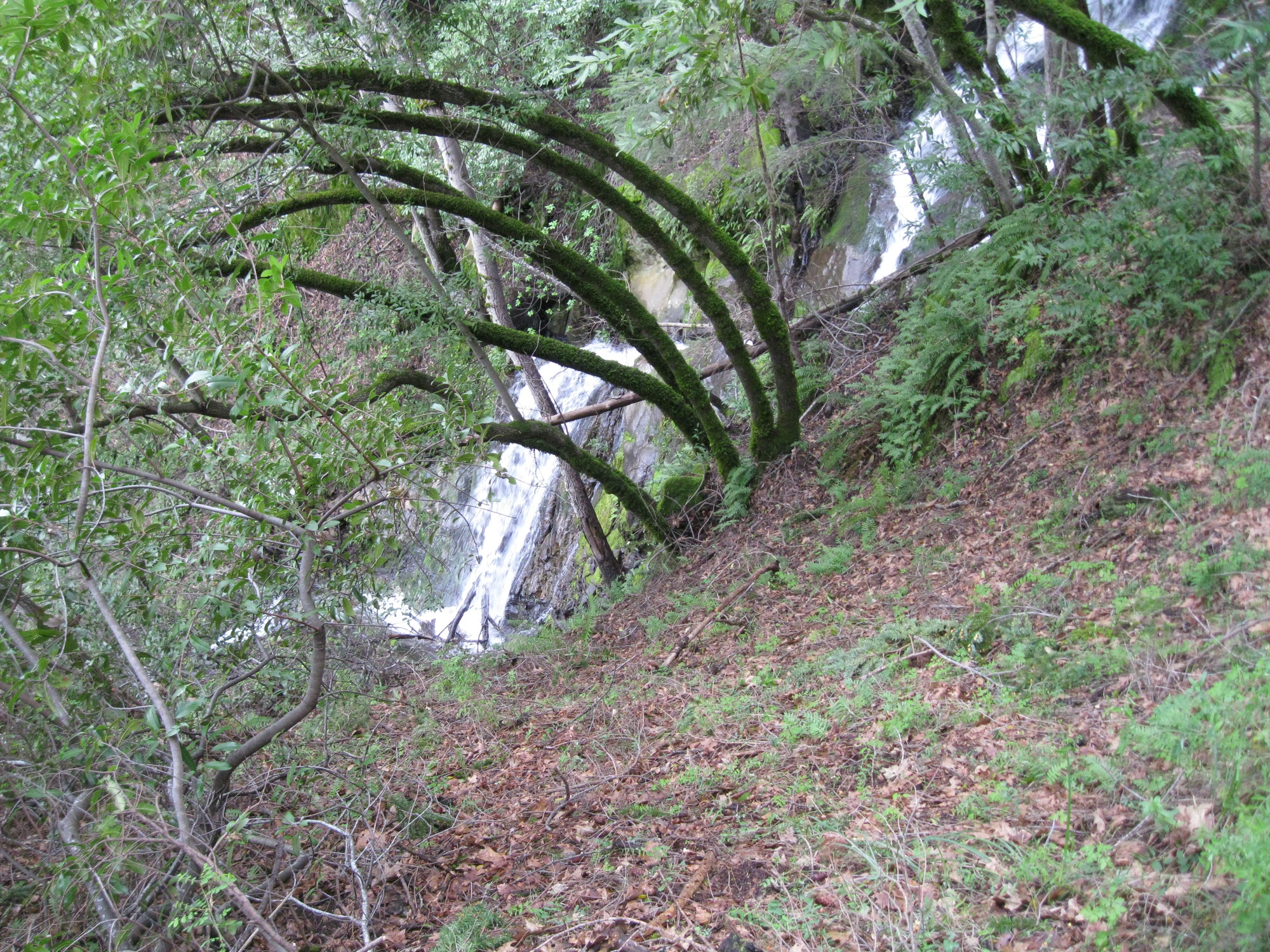
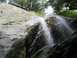
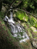
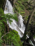
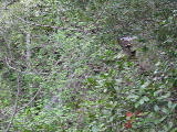
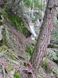
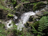
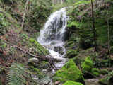
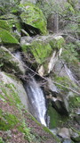
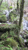
- The size of this set of cascades is impressive, but no single part of it comes close to being as scenic as the well-known falls upstream. at (37.22518, -122.10779):
Poor gps reception - coordinates may be unreliable
taken 2011-03-22:


from the other side, somewhere near the middle:

Videos:
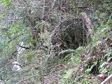
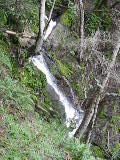
The videos show a fair amount of this waterfall, and the static photos show only small parts, due to the trees and due to dangerously steep terrain limiting my choices of where to see it from. My estimate of its size is unreliable because I only saw bits and pieces of it at any one time, separated by much time looking for a somewhat safe route to the next view.
Beauty: 7.5
Duration: 365 days after a significant rainfall
Height 140 feet (broadly defined)
Height 120 feet
Biggest vertical drop 15 feet
route: The terrain is unusually steep, and I'm reluctant to recommend visiting it at all. If you really want to find it, my best guess is that you should start on the unmarked trail used by rock climbers that goes along the ridge to the east. You will lose the remnants of a trail well before reaching the waterfall.
Last visited 2011-03-22
id: skyline.2
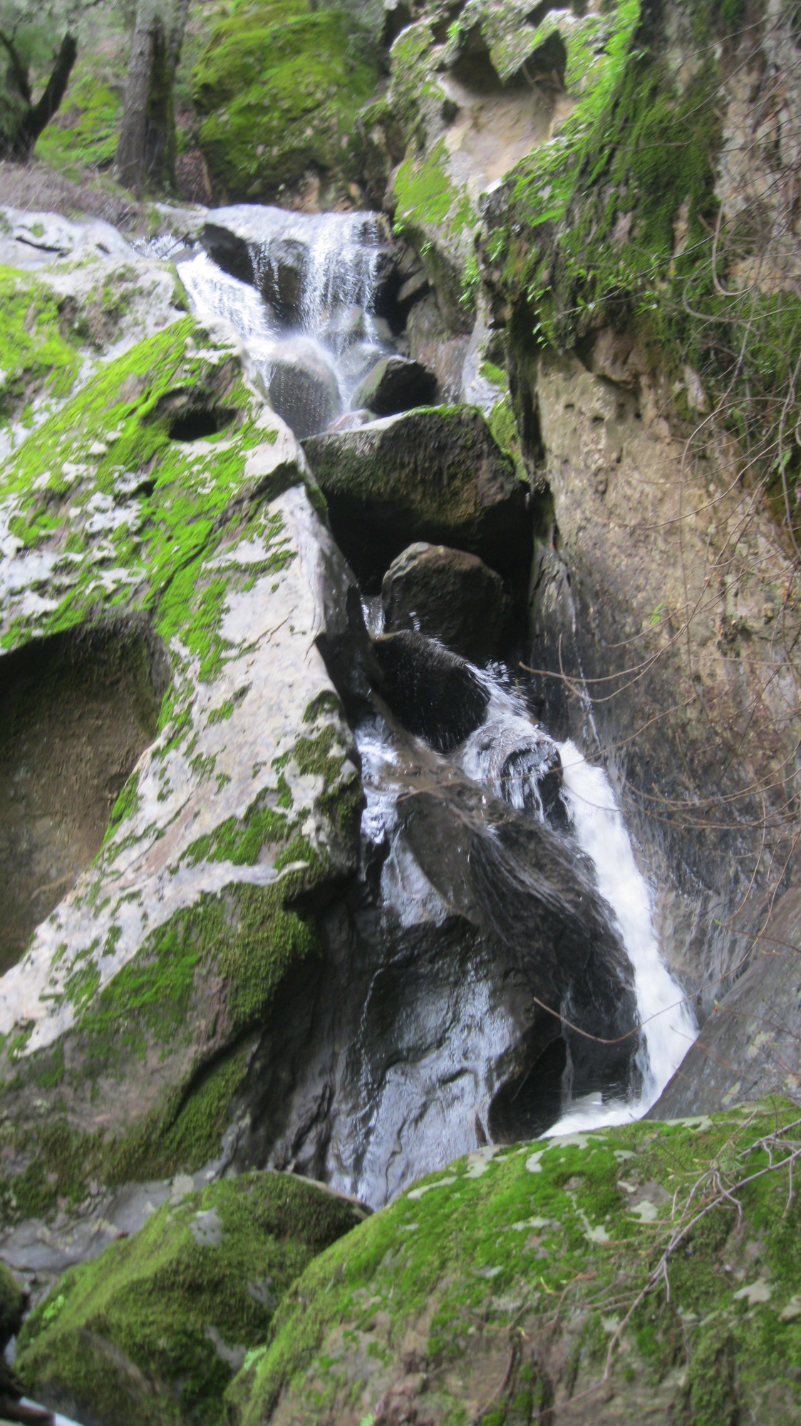
- waterfall at (37.22365, -122.10904):
Poor gps reception - coordinates may be unreliable
taken 2011-03-22:
Hard to reach due to the terrain, and insignificant compared to the other falls on the creek
Beauty: 5
Duration: 365 days after a significant rainfall
Height 10 feet
Biggest vertical drop 8 feet
Number of drops 1
route: I don't recommend looking for this.
Last visited 2011-03-22
id: skyline.3
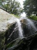
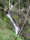
- waterfall at (37.22300, -122.11035):
Poor gps reception - coordinates may be unreliable
taken 2011-03-22:

I'm unsure how much of this to classify as a waterfall. Hard to reach due to the terrain, and insignificant compared to the other falls on the creek.
Beauty: 6
Duration: 365 days after a significant rainfall
Height 30 feet (broadly defined)
Biggest vertical drop 2 feet
route: I don't recommend looking for this.
Last visited 2011-03-22
id: skyline.4
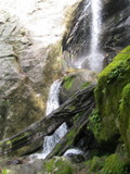
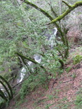
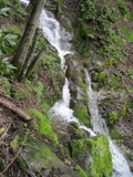
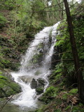
- waterfall at (37.22301, -122.11118):
Poor gps reception - coordinates may be unreliable
taken 2011-03-22:
Video:
Hard to reach due to the terrain, and insignificant.
Beauty: 8
Duration: 365 days after a significant rainfall
Height 22 feet (broadly defined)
Height 18 feet
Biggest vertical drop 15 feet
Terrain: woods, little or no trail
route: My gps reception was very poor in this area, and the routes I took coming and going were unusually steep or covered with dense chaparral. So if you try to find it, expect to be challenged.
Last visited 2011-03-22
id: skyline.5
Long Ridge Open Space Preserve
Peters Creek
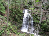
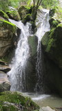
- waterfall at (37.28937, -122.16729):
Name: Peters Creek Falls
taken 2016-01-09:
Videos:
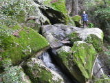
The number of people I saw there suggests it's moderately well known, but the only reference to it that I've been able to find is on a map in Jean Rushmore's book Bay Area Ridge Trail. The trail seems heavily used, and has signs with rock climbing regulations.
Beauty: 8.5
Duration: 365 days after a significant rainfall
Height 32 feet give or take 6 feet
Biggest vertical drop 20 feet
Number of drops 2
Terrain: unofficial trail, frequently used
route: From the Grizzly Flat Trailhead, hike 0.4 miles down Peters Creek trail. Turn right onto the Bay Area Ridge Trail. Shortly after the trail crosses a private paved road (Portola Heights Rd), turn left. The path will follow the creek a half mile downstream to the top of the falls. There are cruder paths that go farther down which look like they are occasionally used by rock climbers.
Last visited 2016-01-09
id: skyline.6
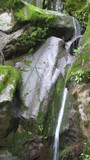
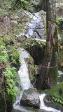
- waterfall at (37.28922, -122.16791):
taken 2016-01-09:
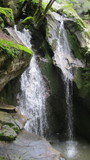
lower section:

Videos:
Beauty: 8
Duration: 365 days after a significant rainfall
Height 37 feet give or take 5 feet
Biggest vertical drop 10 feet
Terrain: vague hints of a trail
Last visited 2016-01-09
id: skyline.7
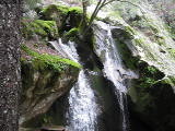
- waterfall at (37.28928, -122.16795):
taken 2016-01-09:
Video:
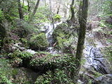
This is close enough to the two falls above that they could be considered a single 200 foot waterfall, but the terrain is steep enough that most people will want to stop near the top of the upper falls.
Beauty: 6
Duration: 365 days after a significant rainfall
Height 47 feet give or take 7 feet
Biggest vertical drop 25 feet
Number of drops 2
Terrain: vague hints of a trail
Last visited 2016-01-09
id: skyline.8
Upper Stevens Creek County Park
Unnamed creek near Grizzly Flat
- waterfall at (37.29701, -122.14281):
taken 2011-05-21:
Close to the Grizzly Flat trail on the north side of Stevens Creek. You only need to walk a short distance from the trail to see it.
Beauty: 4.5
Duration: 30 days after a significant rainfall
Height 30 feet (broadly defined)
Height 13 feet give or take 3 feet
Biggest vertical drop 5 feet
Terrain: woods, little or no trail
Last visited 2011-05-21
id: skyline.9
back to main waterfalls page