Waterfalls around Mt. Tamalpais
The area from Mill Valley and Muir Beach north to Fairfax and west to Kent Lake. The Tom Harrison map for Mt. Tam covers most of it, with small parts shown on his Pine Mountain map.
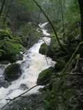
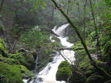
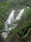
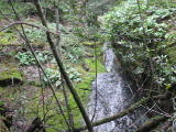
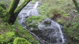
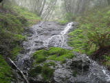
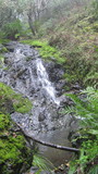
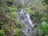
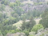
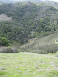
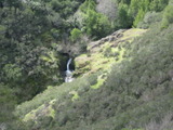
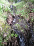
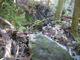
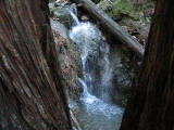
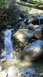
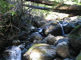
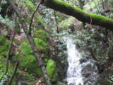
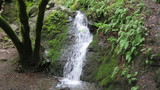
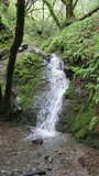
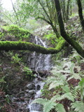
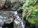
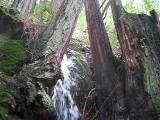
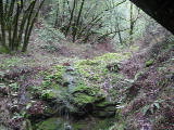
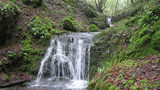
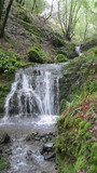
Cascade Canyon Open Space Preserve
Cascade Creek
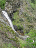
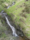
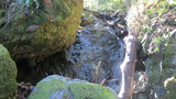
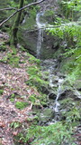
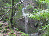
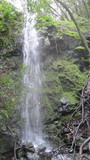
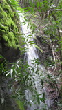
- waterfall at (37.98433, -122.62189):
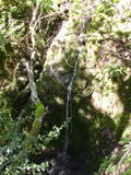
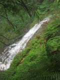
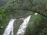
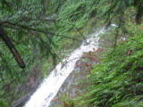
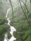
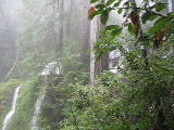
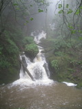
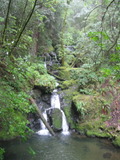
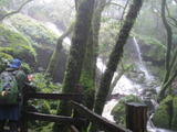
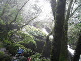
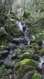
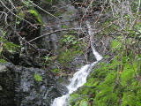
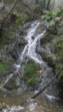
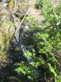
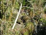
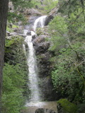
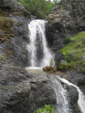
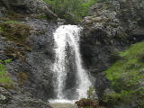
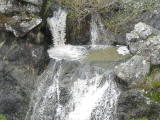
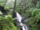
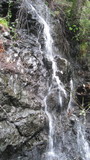
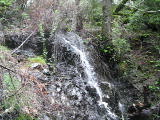
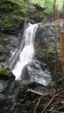
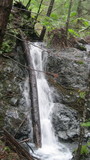
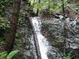
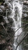
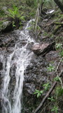
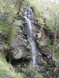
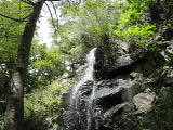
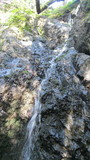
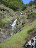
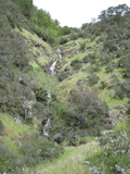
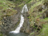
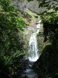
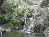
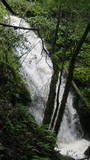
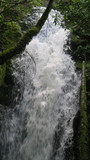
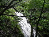
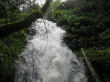
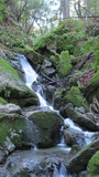
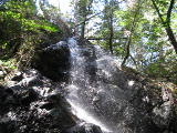
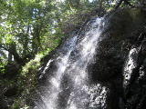
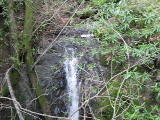
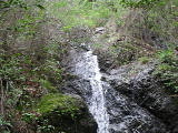
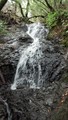
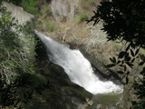
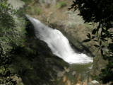
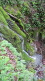
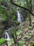
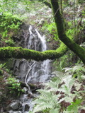
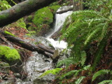
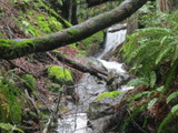
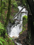
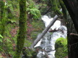
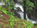
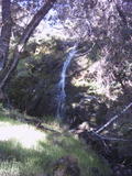
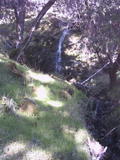
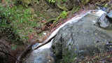
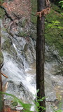
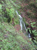
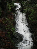
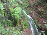
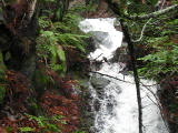
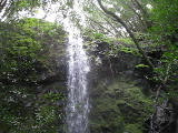
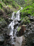
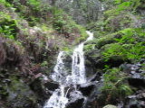
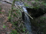
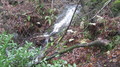
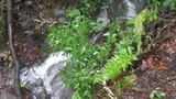
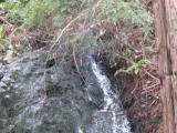
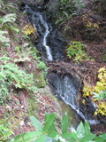
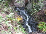
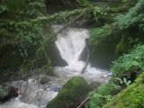
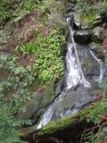
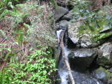
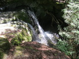
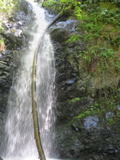
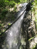
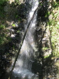
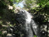
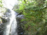
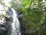
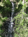
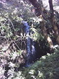
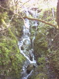
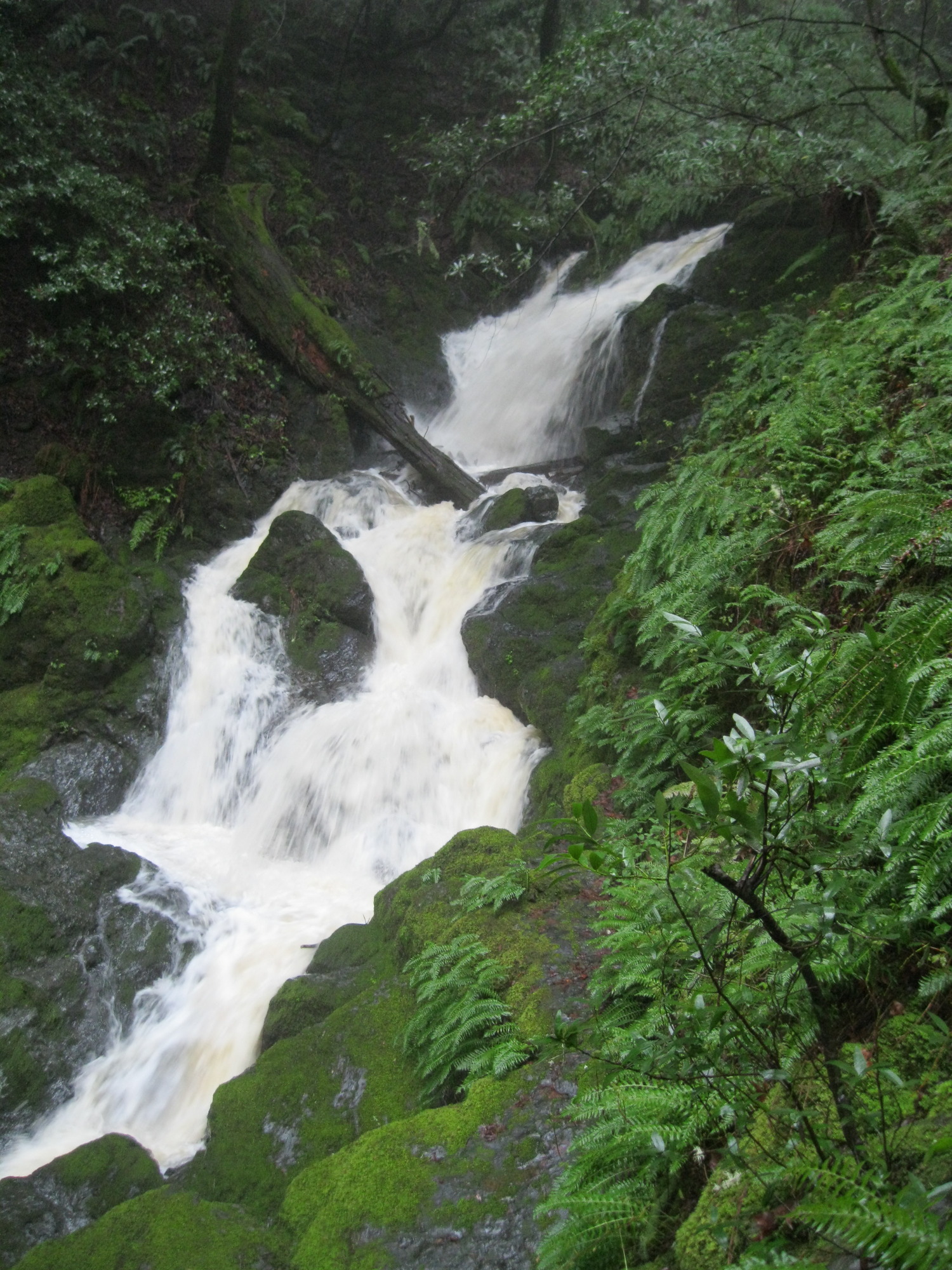
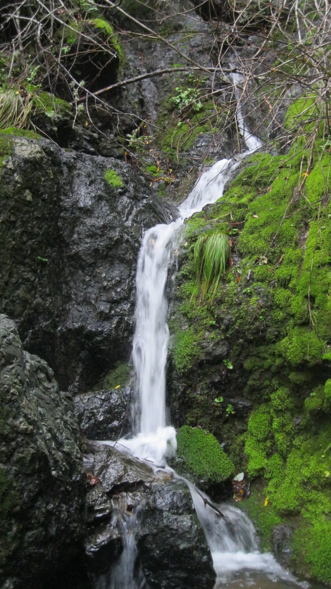
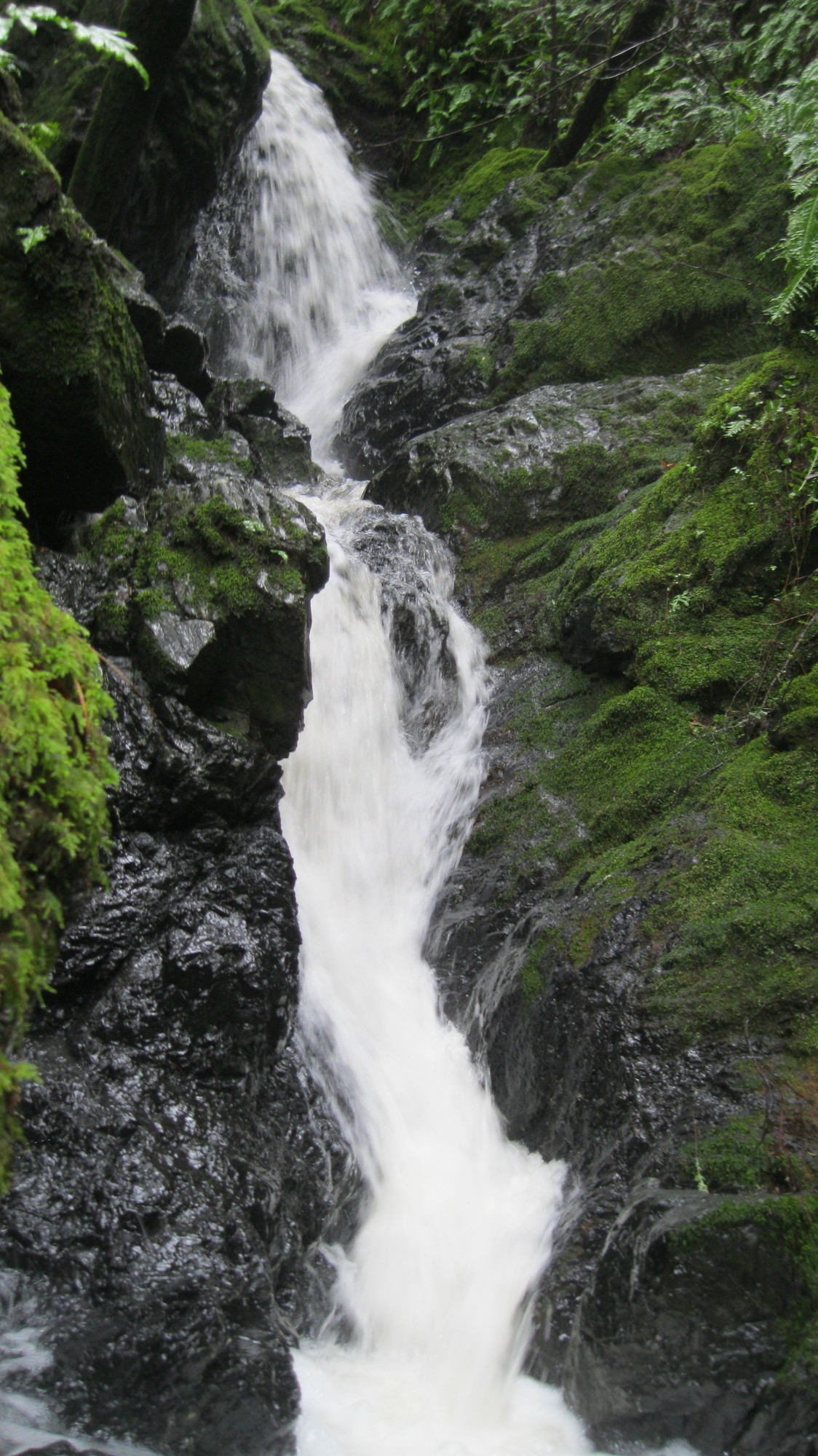
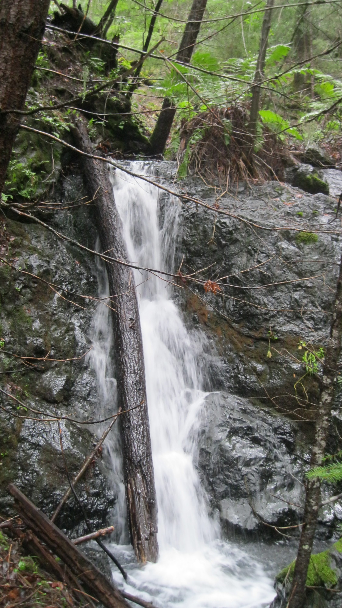
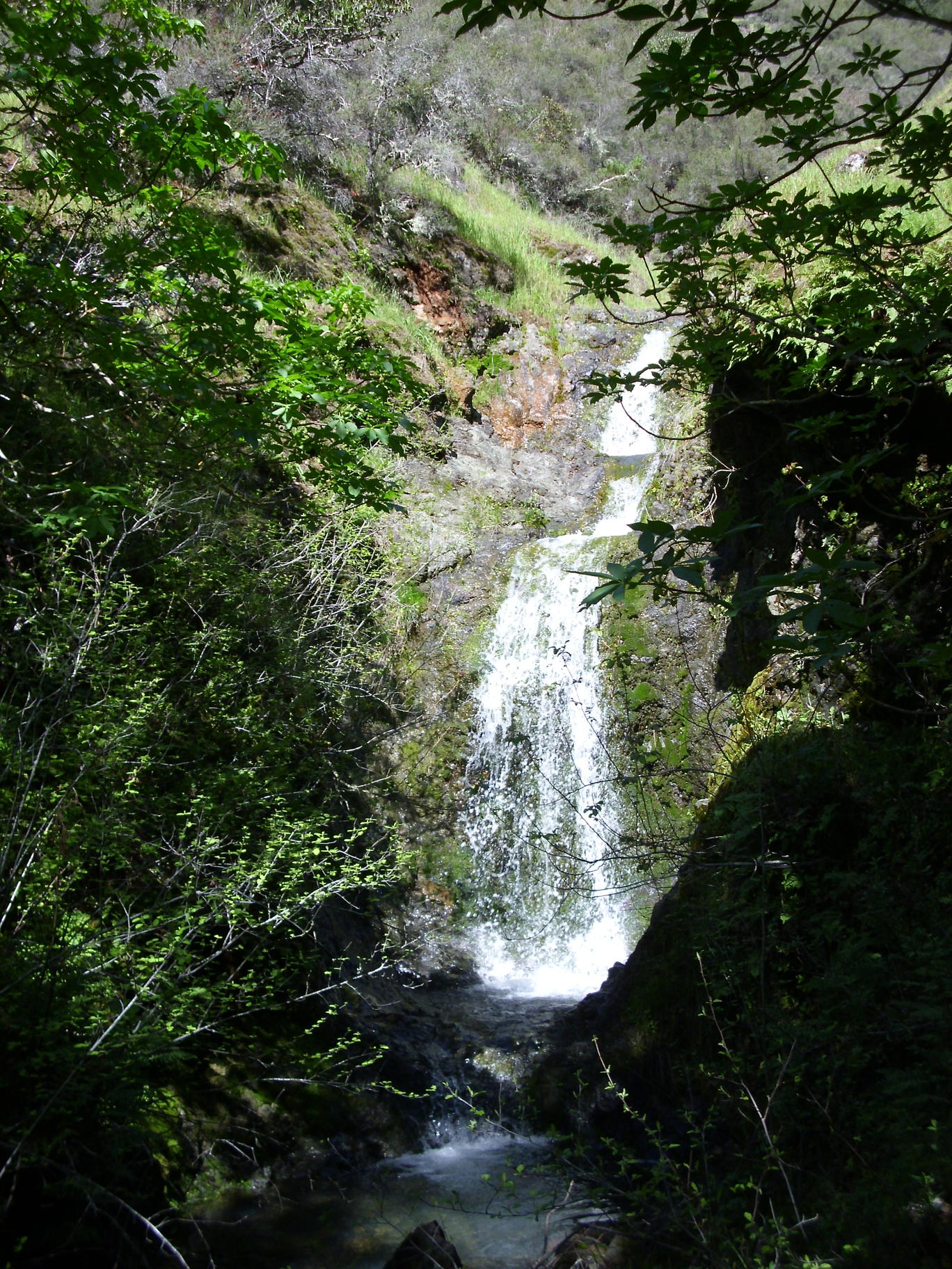
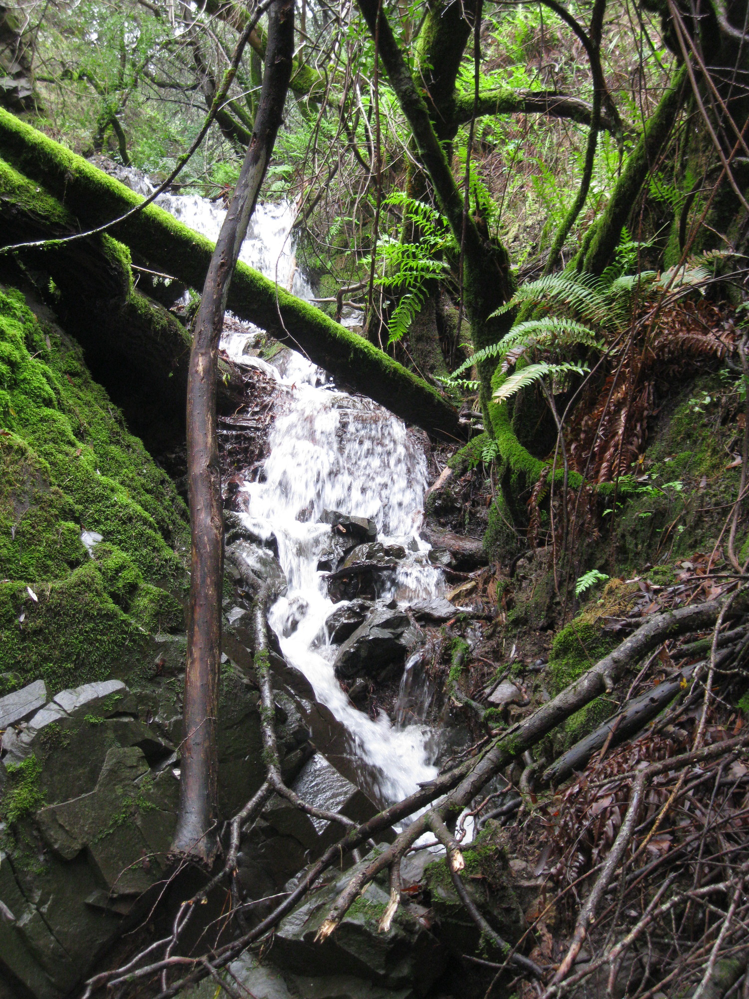
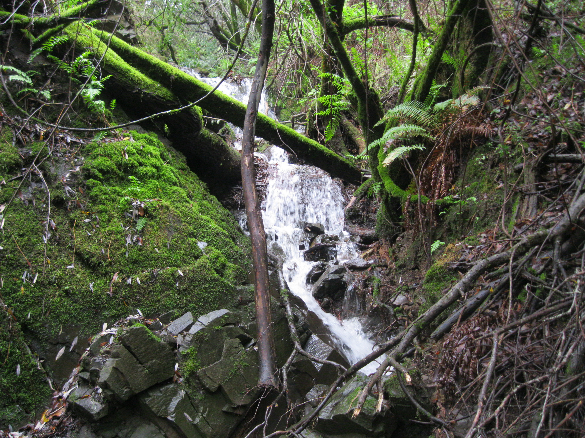
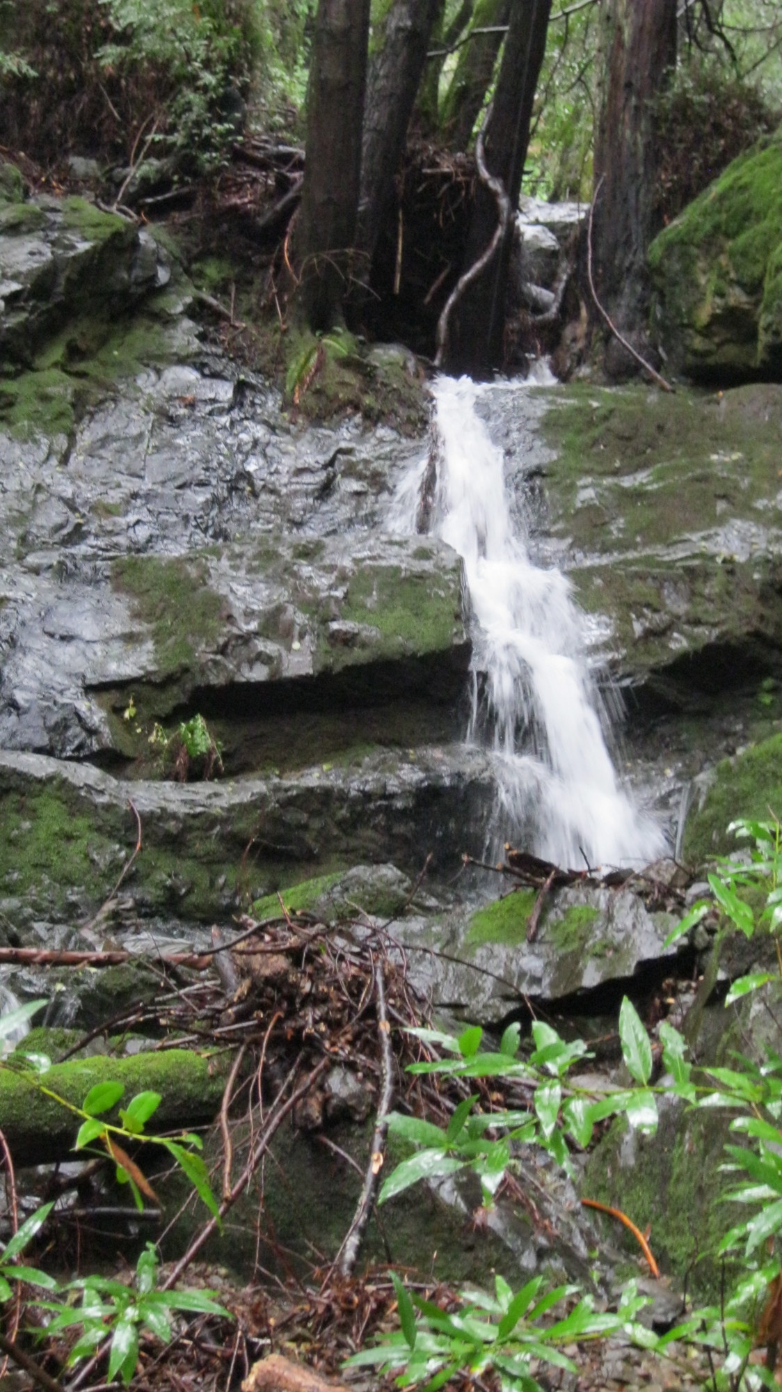
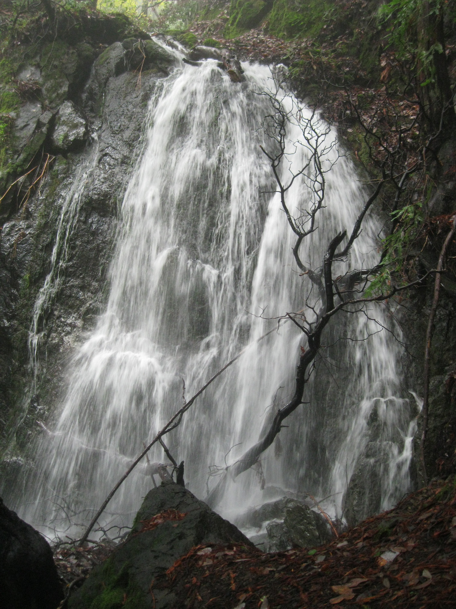
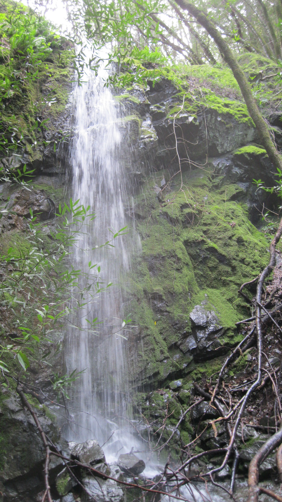
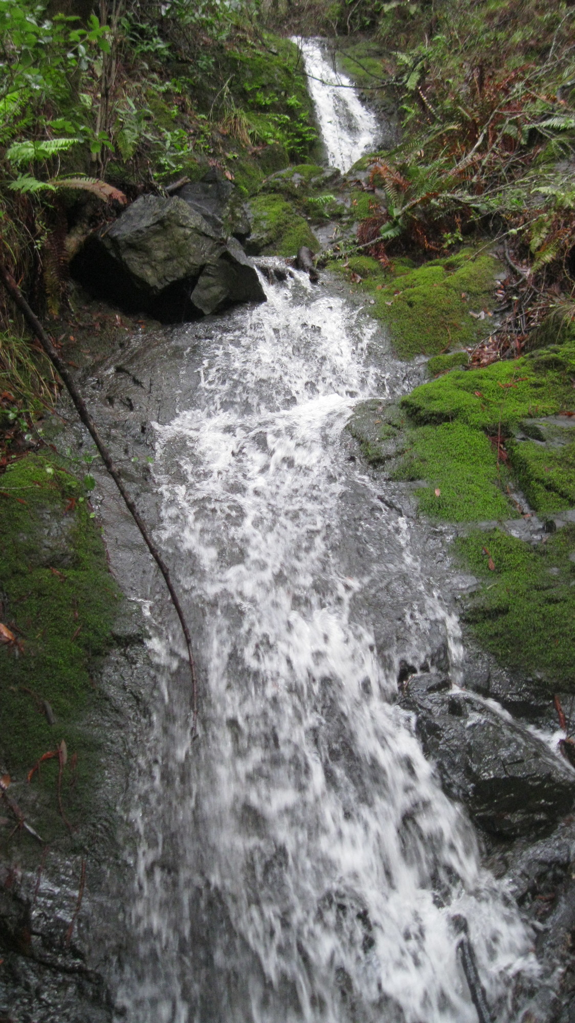
Name: Cascade Falls
taken 2019-02-14:

 taken 2011-03-07:
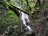
Videos:
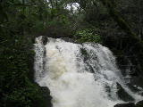
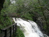
Beauty: 7
Duration: 75 days after a significant rainfall
Height 17 feet (broadly defined)
Height 14 feet
Biggest vertical drop 4 feet
Terrain: well-maintained trail
route: Follow the creek up from the end of Cascade Drive. Parking is limited near the end of the road, but plentiful at the start of Cascade Drive.
Last visited 2019-02-14
id: tam.12
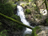
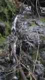
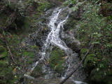
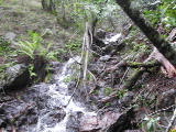
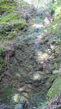
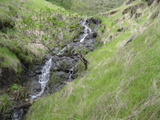
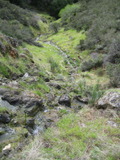
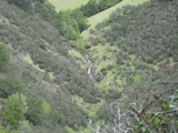
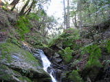
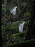
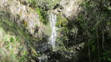
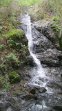
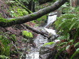
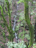
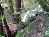
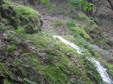
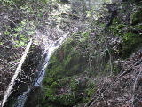
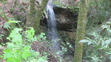
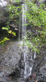
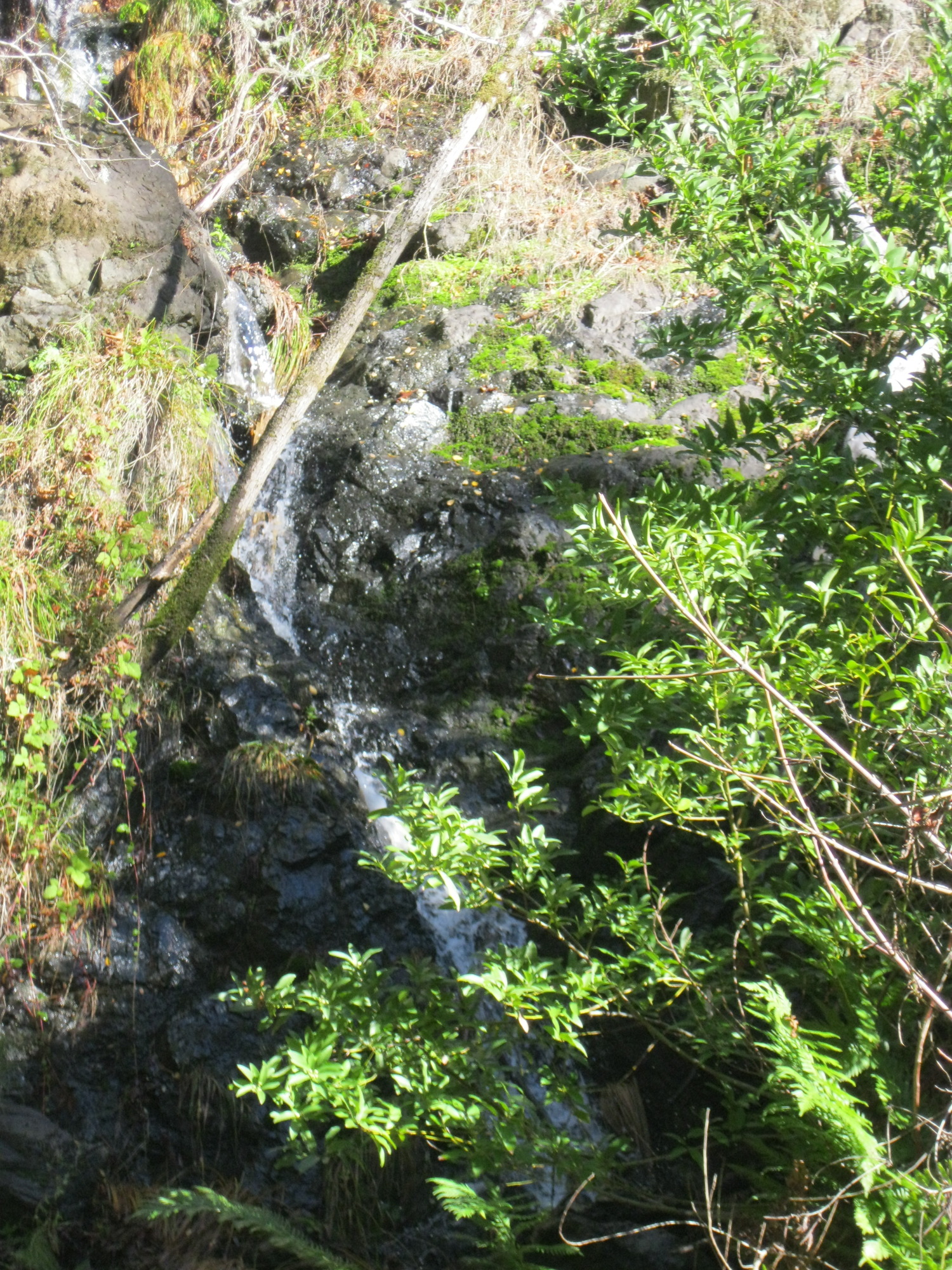
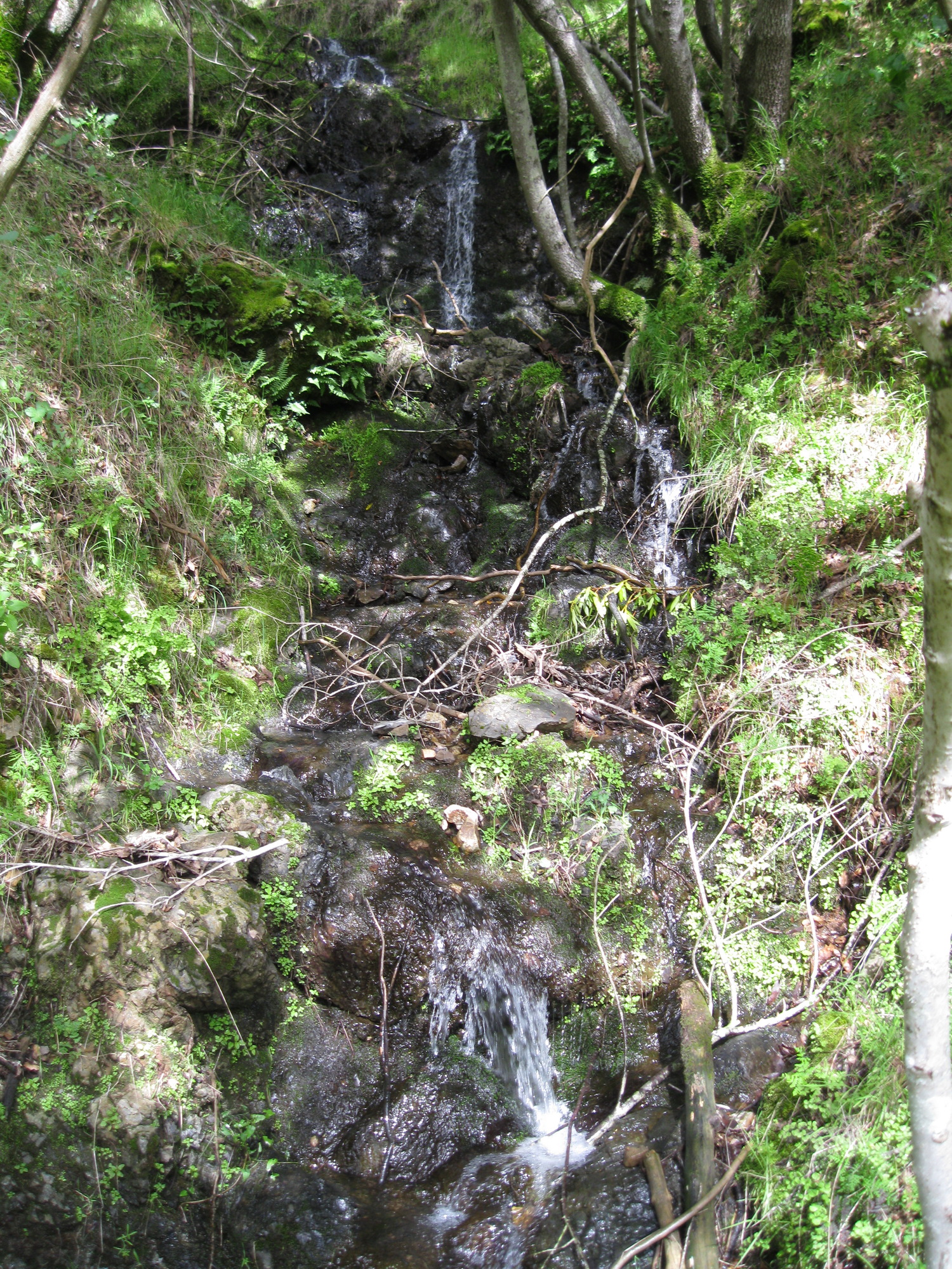
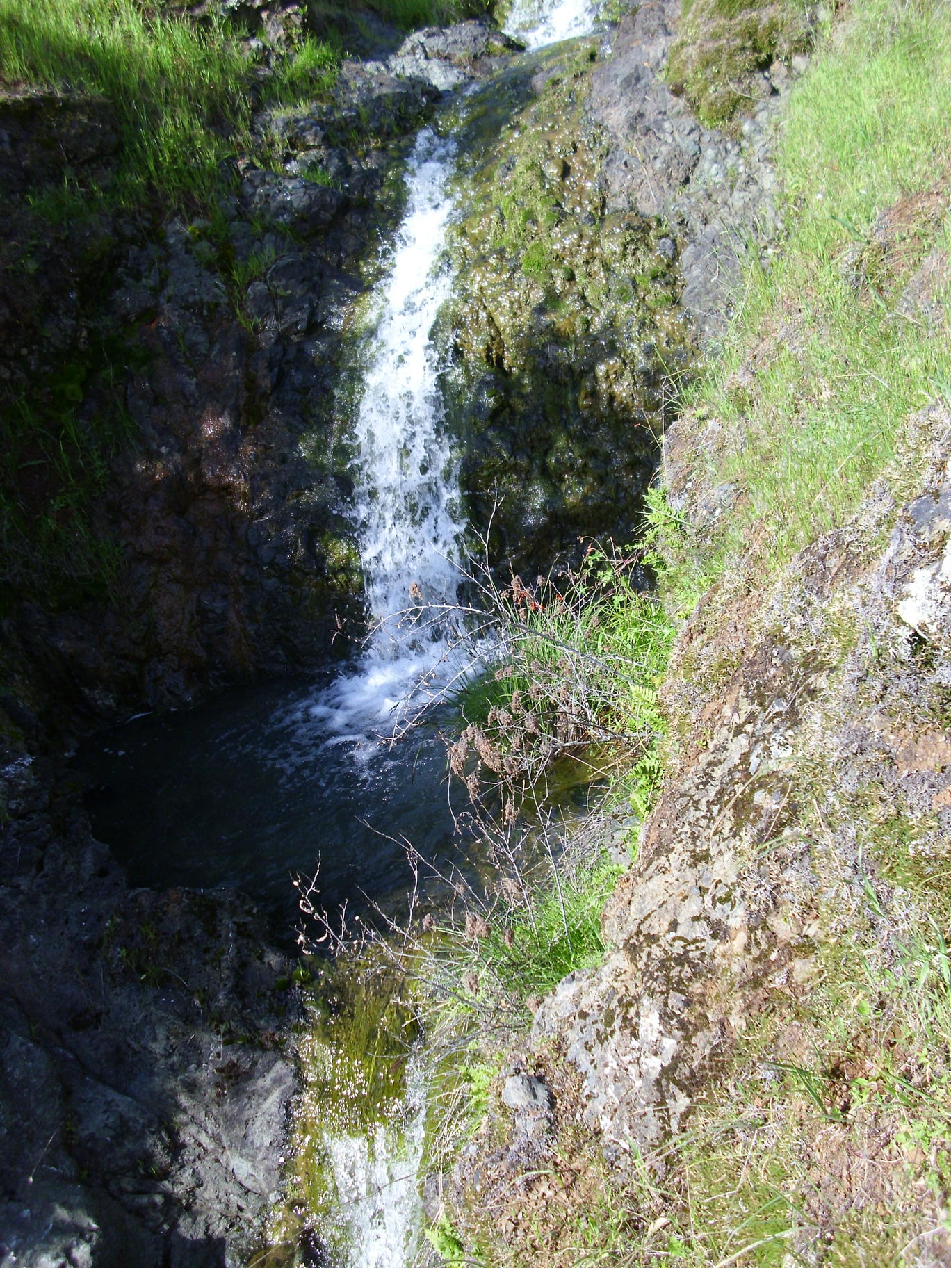
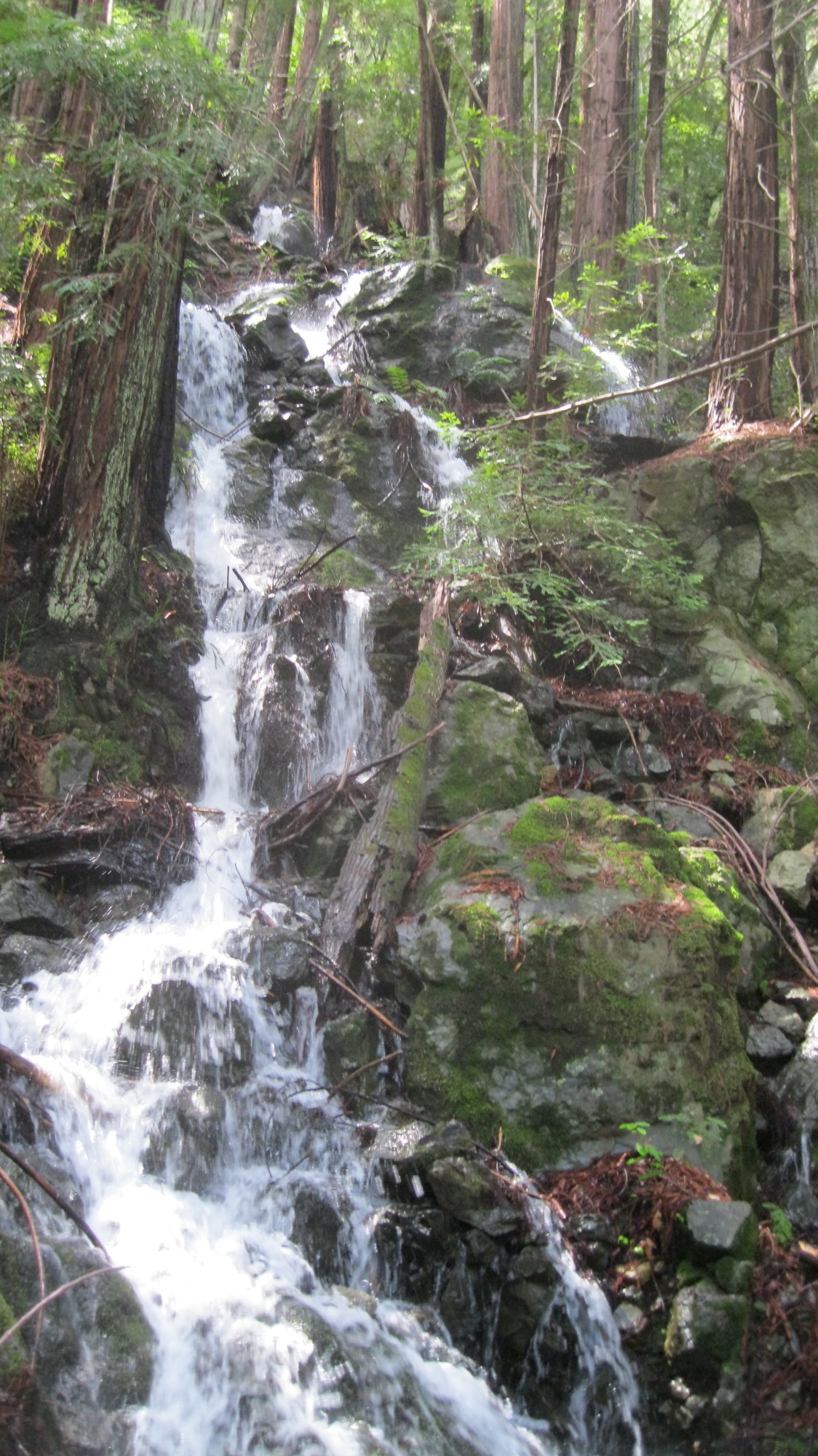
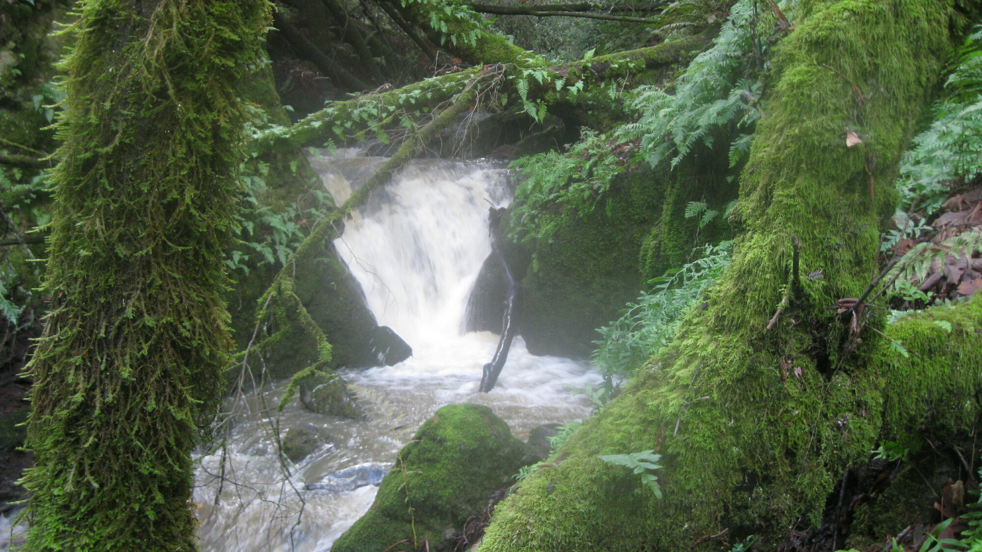
Unnamed creek running south from the middle of the Wagon Wheel Trail
- another quarter mile east at (37.98502, -122.61833):
I'm guessing it's 12 to 15 feet tall, but I didn't get a good view from the west side of the stream, and it's in a steep enough gully to deter me from getting a better view.
Beauty: 6
Duration: 10 days after a significant rainfall
Height 15 feet (broadly defined)
Height 12 feet
Number of drops 1
Terrain: woods, little or no trail
route: It's probably best reached from the east end of the Wagon Wheel Trail, although I haven't tried that.
id: tam.10
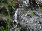
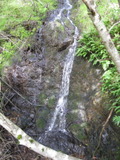
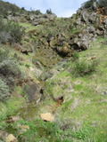
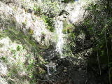
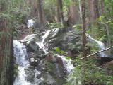
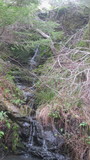
White Hill Open Space Preserve
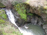
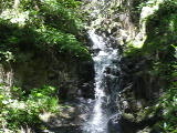
Cascade Creek
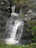
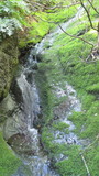
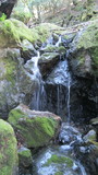
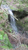
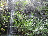
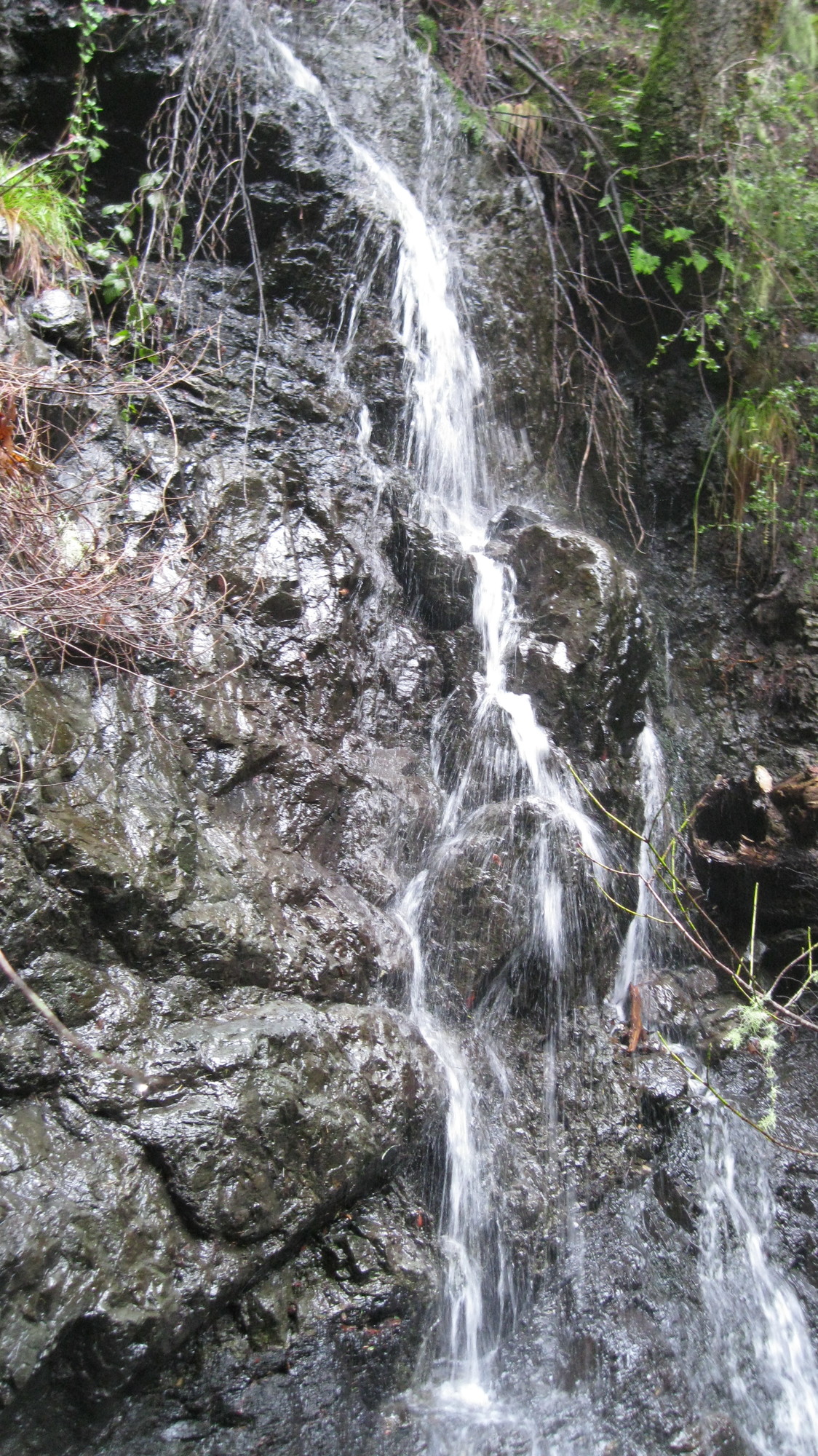
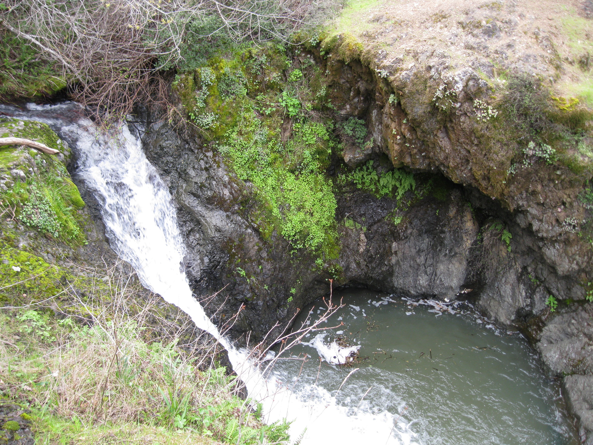
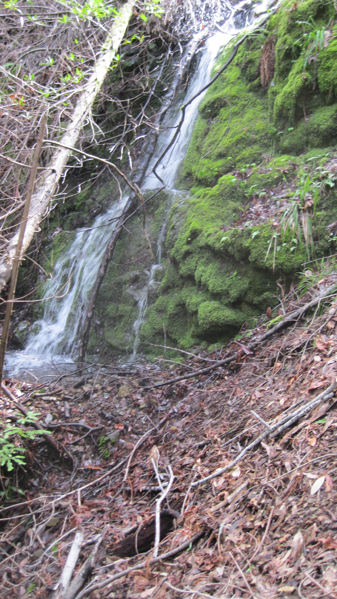
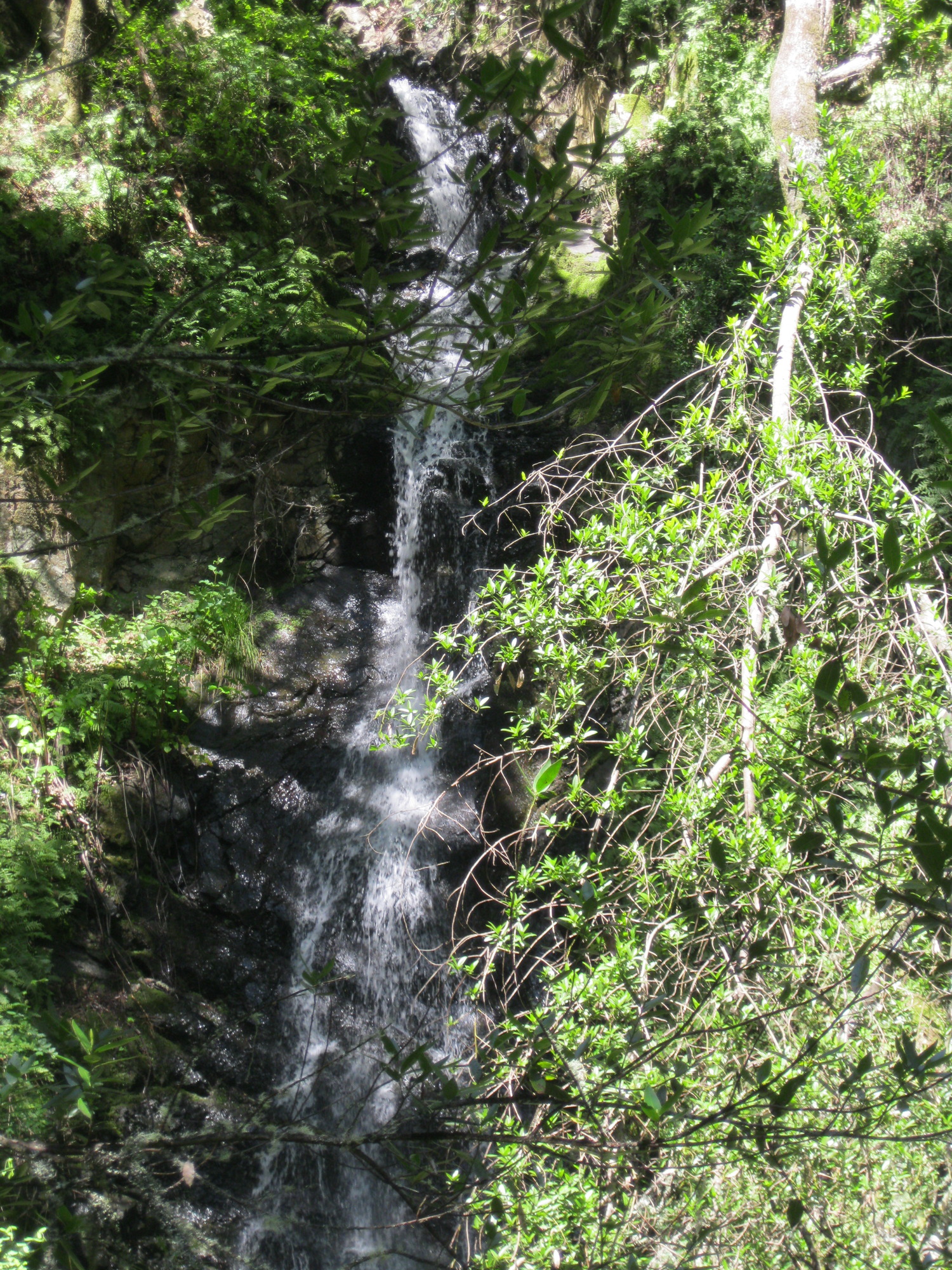
- waterfall at (37.98464, -122.62349):
taken 2011-03-07:

Beauty: 5.5
Duration: 75 days after a significant rainfall
Height 7 feet
Biggest vertical drop 5 feet
Number of drops 2
Terrain: woods, little or no trail
Last visited 2011-03-07
id: tam.13
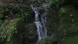
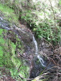
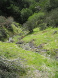
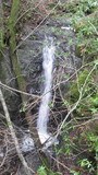
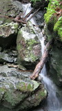
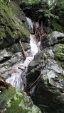
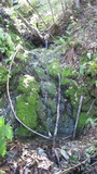
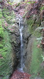
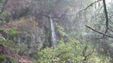
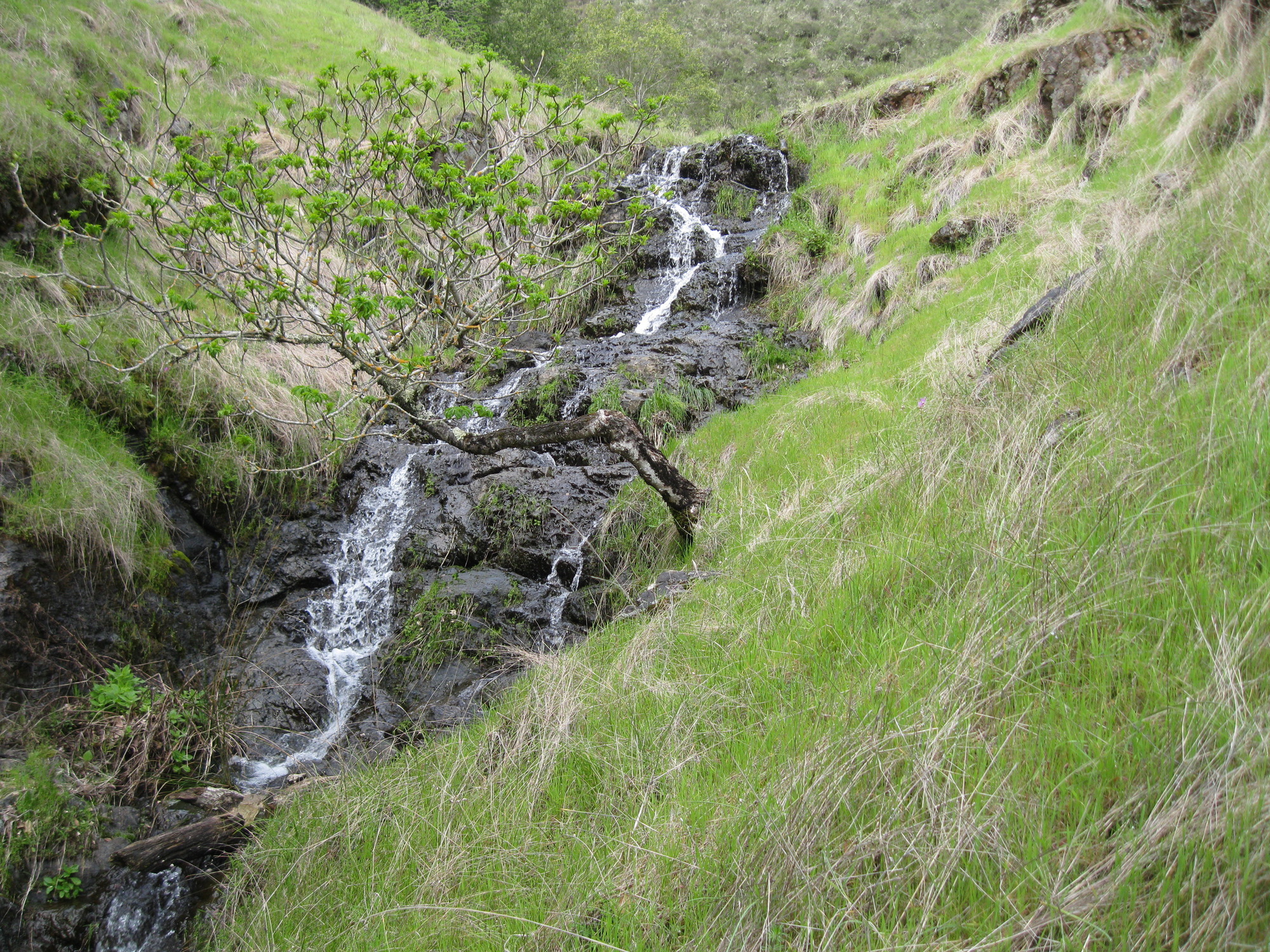
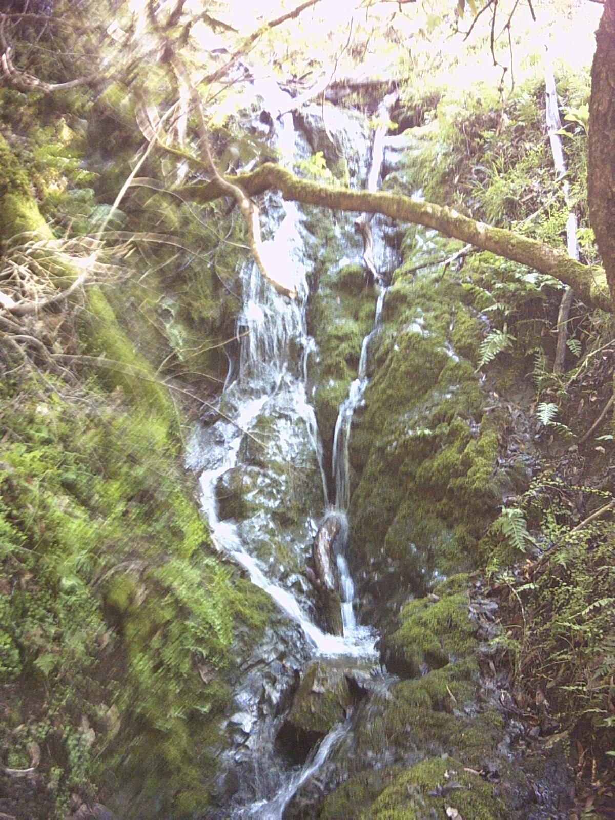
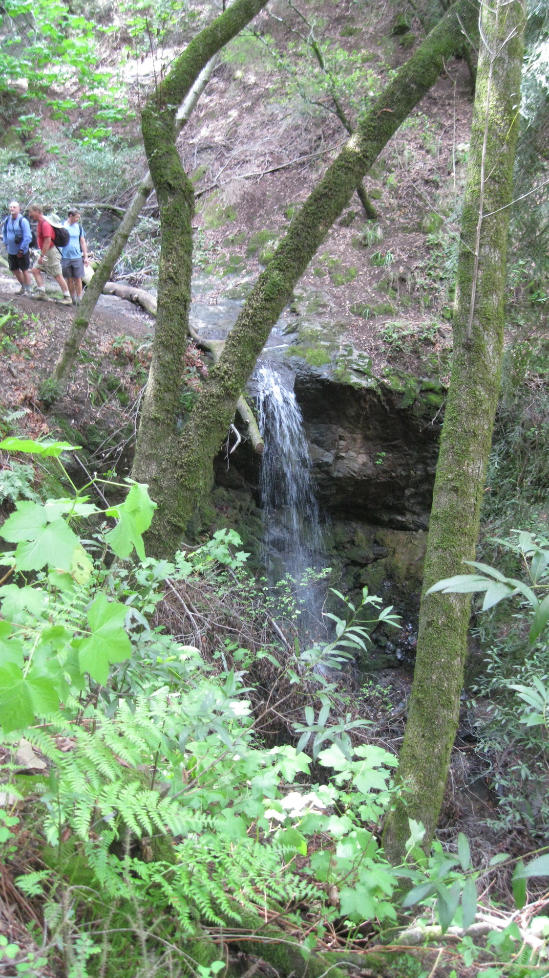
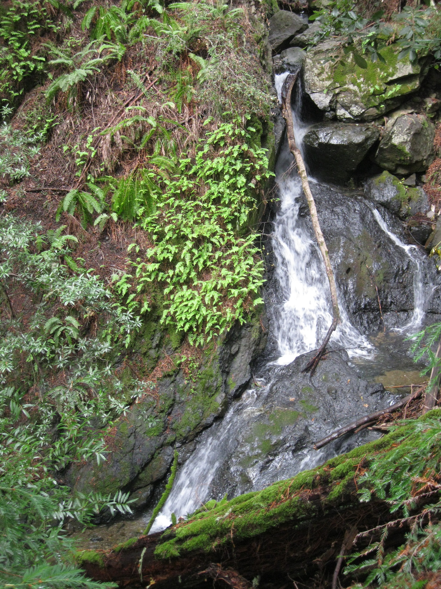
Unnamed creek running south from the western part of the Wagon Wheel Trail
- waterfall at (37.98885, -122.62348):
Beauty: 6
Duration: 5 days after a significant rainfall
Height 25 feet (broadly defined)
Height 12 feet
Biggest vertical drop 7 feet
Terrain: woods, little or no trail
route: I got there by bushwacking east from the previous falls. It should also be reachable with moderate difficulty from the east, upstream, or downstream. If you're not using a gps, I'd guess the easiest way to not get lost looking for it is to head downstream from the Wagon Wheel Trail 1/8 mile after it makes a sudden switchback.
id: tam.9
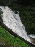
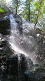
Marin Municipal Water District
Cataract Creek
- waterfall at (37.93248, -122.63575):
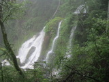
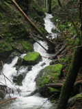
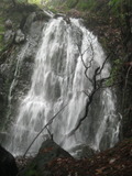
Name: Cataract Falls
Poor gps reception - coordinates may be unreliable
taken 2012-03-25:

Videos:

labeled Fall #1 by waterfallswest.com
Beauty: 8
Duration: 365 days after a significant rainfall
Height 72 feet
Terrain: well-maintained trail
For more info, see:
http://www.waterfallswest.com/waterfall.php?id=256
Last visited 2012-03-25
id: tam.25
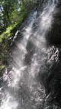
- waterfall at (37.932, -122.63575):
Name: Cataract Falls
Poor gps reception - coordinates may be unreliable
taken 2012-03-25:
Videos:
labeled Fall #2 by waterfallswest.com
Beauty: 9.5
Duration: 365 days after a significant rainfall
Height 59 feet
Terrain: well-maintained trail
For more info, see:
http://www.waterfallswest.com/waterfall.php?id=256
Last visited 2012-03-25
id: tam.26
- waterfall at (37.9315, -122.63575):
Name: Cataract Falls
Poor gps reception - coordinates may be unreliable
taken 2012-03-25:
Video:

labeled Fall #3 by waterfallswest.com
Beauty: 9.5
Duration: 365 days after a significant rainfall
Height 65 feet
Terrain: well-maintained trail
For more info, see:
http://www.waterfallswest.com/waterfall.php?id=256
Last visited 2012-03-25
id: tam.27
- waterfall at (37.93080, -122.63540):
Name: Cataract Falls
Poor gps reception - coordinates may be unreliable
taken 2012-03-25:
Video:
labeled Fall #4 by waterfallswest.com
Beauty: 9.5
Duration: 365 days after a significant rainfall
Height 36 feet
Terrain: well-maintained trail
For more info, see:
http://www.waterfallswest.com/waterfall.php?id=256
Last visited 2012-03-25
id: tam.28
- waterfall at (37.93013, -122.63465):
Poor gps reception - coordinates may be unreliable
taken 2012-03-25:
 taken 2011-04-03:
labeled Fall #5 by waterfallswest.com?
Beauty: 5
Duration: 365 days after a significant rainfall
Height 8 feet
Terrain: well-maintained trail
For more info, see:
http://www.waterfallswest.com/waterfall.php?id=256
Last visited 2012-03-25
id: tam.29
- waterfall at (37.9254, -122.6335):
Poor gps reception - coordinates may be unreliable
taken 2012-03-25:
 taken 2011-04-03:
Video:

labeled Fall #7 by waterfallswest.com
Beauty: 8.5
Duration: 365 days after a significant rainfall
Height 29 feet
Terrain: well-maintained trail
For more info, see:
http://www.waterfallswest.com/waterfall.php?id=256
Last visited 2012-03-25
id: tam.30
- waterfall at (37.92416, -122.62906):
gps coordinates estimated from map, reliability unknown
taken 2012-03-25:
Video:
labeled Fall #9 by waterfallswest.com
Beauty: 8.5
Duration: 365 days after a significant rainfall
Height 44 feet
Terrain: well-maintained trail
For more info, see:
http://www.waterfallswest.com/waterfall.php?id=256
Last visited 2012-03-25
id: tam.31
Unnamed creek on the west side of Oat Hill
- waterfall at (37.947795, -122.646603):
taken 2015-02-07:

Videos:
Beauty: 5.5
Duration: 20 days after a significant rainfall
Height 30 feet give or take 4 feet
Biggest vertical drop 1 feet
Terrain: woods, little or no trail
route: A short but steep distance below the Kent Pump Road
Last visited 2015-02-07
id: tam.66
- waterfall at (37.948500, -122.645475):
taken 2015-02-07:
Video:
Beauty: 3
Duration: 20 days after a significant rainfall
Height 20 feet
Biggest vertical drop 1 feet
Terrain: woods, little or no trail
Last visited 2015-02-07
id: tam.67
Unnamed creek near Old Vee Road
- waterfall at (37.956811, -122.655345):
taken 2015-02-07:
Video:

Beauty: 5
Duration: 28 days after a significant rainfall
Height 10 feet
Biggest vertical drop 4 feet
Terrain: vague hints of a trail
Last visited 2015-02-07
id: tam.68
- waterfall at (37.957127, -122.654688):
upper part taken 2015-02-07:

lower part:

Videos:

Beauty: 6.5
Duration: 28 days after a significant rainfall
Height 57 feet (broadly defined)
Height 50 feet
Biggest vertical drop 8 feet
Terrain: woods, little or no trail
Last visited 2015-02-07
id: tam.69
- waterfall at (37.957577, -122.653824):
taken 2015-02-07:
Video:
Beauty: 4
Duration: 28 days after a significant rainfall
Height 8 feet
Terrain: woods, little or no trail
Last visited 2015-02-07
id: tam.70
- waterfall at (37.958396, -122.650646):
taken 2015-02-07:

Video:
Close enough to the waterfall above it that they could be considered one 25 foot falls
Beauty: 6
Duration: 28 days after a significant rainfall
Height 11 feet
Biggest vertical drop 3 feet
Terrain: woods, little or no trail
Last visited 2015-02-07
id: tam.71
- waterfall at (37.958298, -122.650379):
taken 2015-02-07:
Video:
Close enough to the waterfall below it that they could be considered one 25 foot falls
Beauty: 4.5
Duration: 28 days after a significant rainfall
Height 9 feet
Biggest vertical drop 1 feet
Terrain: woods, little or no trail
Last visited 2015-02-07
id: tam.72
Unnamed creek flowing into the south end of Kent Lake
- waterfall at (37.95897, -122.65785):
taken 2012-12-19:
Video:
Beauty: 5
Duration: 20 days after a significant rainfall
Height 36 feet
Biggest vertical drop 2 feet
Terrain: well-maintained trail
Last visited 2012-12-19
id: tam.52
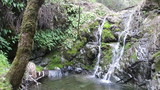
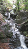
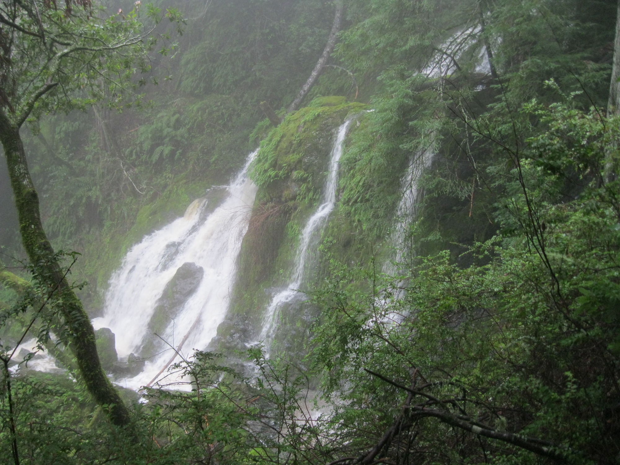
Little Carson Creek
- waterfall at (37.96993, -122.64489):
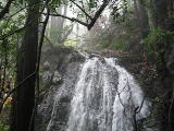
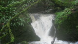
Name: Carson Falls
taken 2012-03-25:
view from middle:
a 25 foot waterfall at the top that is somewhat separate from the main one:
a glimpse from a distant ridge:
Photos on other sites:
http://www.flickr.com/photos/7888710@N04/7025025213/in/set-72157624454553084
Videos:
Beauty: 9.5
Duration: 45 days after a significant rainfall
Height 125 feet (broadly defined)
Height 100 feet
Biggest vertical drop 40 feet
Terrain: well-maintained trail
Last visited 2012-03-25
id: tam.24
- waterfall at (37.967423, -122.646687):
taken 2019-01-09:

Video:
Beauty: 6.5
Duration: 60 days after a significant rainfall
Height 15 feet
Biggest vertical drop 4 feet
Terrain: vague hints of a trail
route: a short, steep walk below the Carson Falls trail
Last visited 2019-01-09
id: tam.87
Unnamed creek flowing south into Little Carson Creek, west of carson Falls
- waterfall at (37.967399, -122.647513):
taken 2019-01-09:
Video:
visible from the Carson Falls trail; some nice azaleas near the top
Beauty: 6.5
Duration: 60 days after a significant rainfall
Height 20 feet
Biggest vertical drop 4 feet
Terrain: vague hints of a trail
route: there's something resembling a path a bit west of the creek
Last visited 2019-01-09
id: tam.86
Unnamed creek flowing south from Pine Mountain into Little Carson Creek, near Kent Pump Rd
- waterfall at (37.969219, -122.653860):
taken 2019-01-09:
Video:
Beauty: 5.5
Duration: 14 days after a significant rainfall
Height 9 feet
Biggest vertical drop 2 feet
Terrain: woods, little or no trail
Last visited 2019-01-09
id: tam.100
- waterfall at (37.972325, -122.654176):
taken 2019-01-09:
Video:
Beauty: 5.5
Duration: 7 days after a significant rainfall
Height 20 feet (broadly defined)
Height 12 feet
Biggest vertical drop 3 feet
Terrain: woods, little or no trail
Last visited 2019-01-09
id: tam.101
Unnamed creek flowing south from the north end of Pine Mountain Road to Big Carson Creek
- waterfall at (37.99282, -122.66715):
Name: Big Carson Creek Falls
taken 2011-04-14:
upper drop (not visible at the main drop):

Video:
Best seen from the west side.
Beauty: 8
Duration: 30 days after a significant rainfall
Height 38 feet (broadly defined)
Height 25 feet
Biggest vertical drop 25 feet
Number of drops 1
Terrain: vague hints of a trail
route: From Big Carson Ridge, follow Pine Mountain Road southeast. About 1/3 mile before it crosses Big Carson Creek, follow the west side of a small stream down until it gets steep approaching Big Carson Creek, then traverse west about 0.1 mile, descending to Big Carson Creek as you approach the larger side creek. (There's probably a better route that I didn't find.) You could also follow Pine Mountain Road along the south side of Big Carson Creek and head north - that means a less hiking off-trail, but with a much steeper section just as you reach the south side of the creek.
Last visited 2011-04-14
id: tam.20
Unnamed creek flowing west-southwest from the west end of White Hill Road to Big Carson Creek
- waterfall at (37.992992, -122.653784):
taken 2018-01-13:
Beauty: 6
Duration: 3 days after a significant rainfall
Height 21 feet
Biggest vertical drop 10 feet
Terrain: vague hints of a trail
Last visited 2018-01-13
id: tam.96
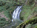
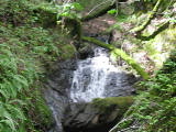
Unnamed creek flowing west from the west end of Cascade Canyon Road toward the Mailliard Camp site
- waterfall at (37.983248, -122.653516):
taken 2018-01-13:
partly hidden by azaleas
Beauty: 5
Duration: 6 days after a significant rainfall
Height 16 feet
Biggest vertical drop 3 feet
Terrain: woods, little or no trail
route: best reached via a meadow on the south side
Last visited 2018-01-13
id: tam.97
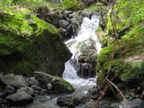
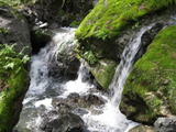
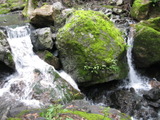
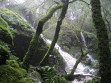
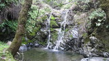
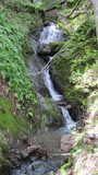
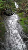
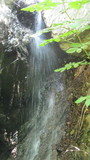
Cascade Creek
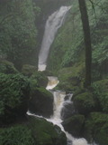
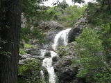
- waterfall at (37.98898, -122.63216):
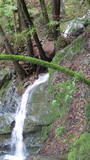
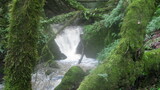
Name: The Inkwell
taken 2011-03-07:

from a hill to the northeast:
 taken 2012-05-28:
A good place to swim in late spring.
Beauty: 8
Duration: 60 days after a significant rainfall
Height 19 feet give or take 3 feet
Biggest vertical drop 3 feet
Number of drops 2
Terrain: unofficial trail, some difficulties
route: There are two trails down to it from the White Hill Fire Rd (you may need to look carefully to see where they start). There is also a trail to it that starts near the bottom of the Cascade Canyon Rd (also known as the Repack Rd) just above where it meets San Anselmo Creek - stay right on any intersection. Many people get to this waterfall by continuing up from the top of Cascade Falls, but that's harder.
Last visited 2012-05-28
id: tam.14
Unnamed creek running southeast from the intersection of the White Hill Fire Rd and the Summit Fire Rd
- waterfall at (37.99236, -122.63498):
taken 2011-03-07:
Beauty: 4.5
Duration: 12 days after a significant rainfall
Height 7 feet
Biggest vertical drop 4 feet
Number of drops 1
Terrain: woods, little or no trail
route: Descend from the White Hill Fire Rd between where it meets the Blue Ridge Fire Rd and the Summit Fire Rd.
Last visited 2011-03-07
id: tam.16
Unnamed creek running south from the intersection of the White Hill Fire Rd and the Blue Ridge Fire Rd
- waterfall at (37.99156, -122.63432):
taken 2011-03-07:
Beauty: 6
Duration: 14 days after a significant rainfall
Height 18 feet
Biggest vertical drop 1 feet
Number of drops 2
Terrain: woods, little or no trail
route: Descend from the White Hill Fire Rd between where it meets the Blue Ridge Fire Rd and the Summit Fire Rd.
Last visited 2011-03-07
id: tam.15
- waterfall at (37.99240, -122.63429):
taken 2011-03-07:

Beauty: 5
Duration: 12 days after a significant rainfall
Height 25 feet (broadly defined)
Height 7 feet
Biggest vertical drop 3 feet
Terrain: woods, little or no trail
route: Descend from the White Hill Fire Rd where it meets the Blue Ridge Fire Rd.
Last visited 2011-03-07
id: tam.17
Unnamed creek flowing southwest from 1/4 mile north of the Inkwell
- waterfall at (37.99116, -122.63271):
taken 2011-03-07:
This might be somewhat impressive with a really heavy flow, but it will usually disappoint.
Beauty: 4
Beauty: 5 (including beauty of the hike to the falls)
Duration: 2 days after a significant rainfall
Height 30 feet (broadly defined)
Height 10 feet
Biggest vertical drop 4 feet
Terrain: moderate brush, little or no trail
route: Traverse southeast from the White Hill Fire Rd where it meets the Blue Ridge Fire Rd.
Last visited 2011-03-07
id: tam.18
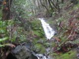
Unnamed creek running south from White Hill
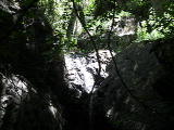
- waterfall on stream at (37.98886, -122.62863):
 taken 2011-03-07:
the upper part:
view from an unofficial trail 1/4 mile south:
The main drop is about 12 feet
Beauty: 8
Duration: 25 days after a significant rainfall
Height 80 feet (broadly defined)
Height 50 feet
Biggest vertical drop 2 feet
Number of drops 3
Terrain: vague hints of a trail
route: Descend from White Hill by following the ridge south from the summit and going down the west side after the fire road veers east (steep, grassy, no trail). There's a good trailhead for this on Sir Francis Drake Blvd near the top of the big hill west of Fairfax. A shorter (but not easier) route is to follow a crude trail upstream from Cascade Falls for at least 1/3 mile, and look for a trail going up the largest side stream. Note that this involves a somewhat tricky creek crossing at the top of Cascade Falls, and the parking near the end of Cascade Drive is very limited.
Last visited 2011-03-07
id: tam.7
- waterfall at (37.98808, -122.62918):

Beauty: 8
Duration: 25 days after a significant rainfall
Height 26 feet (broadly defined)
Height 12 feet
Biggest vertical drop 6 feet
Terrain: vague hints of a trail
route: just downstream from the prior one
id: tam.8
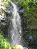
San Anselmo Creek
- waterfall at (37.981366, -122.634258):
taken 2015-02-28:
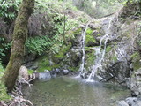
Video:
There's a 2 foot deep pool at the base, and another pool with a rope swing 100 feet downstream.
Beauty: 6.5
Duration: 45 days after a significant rainfall
Height 9 feet give or take 1 feet
Biggest vertical drop 4 feet
Terrain: unofficial trail, some difficulties
route: There are some obscure paths along San Anselmo Creek.
Last visited 2015-02-28
id: tam.76
Unnamed creek flowing northeast into San Anselmo Creek west of Happersberger Point
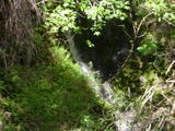
- waterfall at (37.979689, -122.629296):
taken 2019-02-14:

Videos:
Beauty: 7
Duration: 21 days after a significant rainfall
Height 22 feet
Biggest vertical drop 2 feet
Terrain: unofficial trail, some difficulties
route: Follow the official San Anselmo Creek trail to the end, then find paths of varying quality that continue in that direction. About 100 feet downstream of where this creek meets San Anselmo Creek, there's a fairly well-travelled path that heads up from San Anselmo Creek straight to the waterfall. Note that in order to catch it at the flood-stage levels shown here, I needed to wade through foot-deep waters where the official trail crosses San Anselmo Creek. That required careful attention. I looked around for alternative crossings, but none looked better.
Last visited 2015-02-28
id: tam.75
Carey Camp Creek
- waterfall at (37.976449, -122.625376):
taken 2015-02-28:
just downstream from this is an old dam with a 6 foot waterfall (which I don't count because it's artificial)
Beauty: 4
Duration: 25 days after a significant rainfall
Height 13 feet
Terrain: unofficial trail, frequently used
route: just below a path that extends Pine Mountain Tunnel Road
Last visited 2015-02-28
id: tam.74
Unnamed creek flowing northeast into Carey Camp Creek
- waterfall at (37.975999, -122.626719):
taken 2015-02-28:
Beauty: 4.5
Duration: 21 days after a significant rainfall
Height 18 feet (broadly defined)
Height 6 feet
Biggest vertical drop 1 feet
Terrain: woods, little or no trail
Last visited 2015-02-28
id: tam.73
Swede George Creek
- waterfall at (37.93065, -122.61445):
taken 2014-02-21:

Video:
Beauty: 3
Duration: 30 days after a significant rainfall
Height 10 feet
Terrain: woods, little or no trail
route: Just upstream from the High Marsh Trail
Last visited 2014-02-21
id: tam.55
- waterfall at (37.93572, -122.62087):
taken 2014-02-21:

Video:
Beauty: 4
Duration: 30 days after a significant rainfall
Height 10 feet
Biggest vertical drop 6 feet
Terrain: woods, little or no trail
Last visited 2014-02-21
id: tam.56
East Fork Swede George Creek
- waterfall at (37.93995, -122.62350):
taken 2014-02-21:
Video:
Beauty: 5
Duration: 60 days after a significant rainfall
Height 20 feet
Biggest vertical drop 8 feet
Number of drops 2
Terrain: woods with thick brush
route: It was hard to reach from the south side (too many bushes and logs). The north side didn't look much better.
Last visited 2014-02-21
id: tam.57
Van Wyck Creek
- waterfall at (37.946555, -122.622561):
taken 2017-01-01:
Video:
Beauty: 5.5
Duration: 45 days after a significant rainfall
Height 15 feet
Biggest vertical drop 2 feet
Terrain: unofficial trail, frequently used
route: a short distance upstream from the Kent Trail
Last visited 2017-01-01
id: tam.77
West Fork Lagunitas Creek
- waterfall at (37.93732, -122.59946):
taken 2016-03-19:
Videos:
Beauty: 7
Duration: 365 days after a significant rainfall
Height 35 feet give or take 3 feet
Biggest vertical drop 6 feet
Number of drops 1
Terrain: unofficial trail, some difficulties
route: The simplest route is to follow the creek upstream from Lake Lagunitas. I initially got there by following the Four Canyons "trail", which is not at all obvious. You will probably need to use the gpx file below to find it. There's a recently fallen Madrone blocking the place where it starts west from the Colier Spring Trail.
route: download gpx
Last visited 2016-03-19
id: tam.23
- waterfall at (37.93867, -122.59879):
taken 2012-12-05:
Beauty: 5
Duration: 365 days after a significant rainfall
Height 12 feet (broadly defined)
Height 5 feet
Biggest vertical drop 5 feet
Number of drops 2
Terrain: unofficial trail, some difficulties
route: Follow the creek up from Lake Lagunitas; a trail starts on the east side
Last visited 2012-12-05
id: tam.47
- waterfall at (37.93758, -122.59879):
taken 2014-02-21:
Beauty: 4
Duration: 365 days after a significant rainfall
Height 10 feet
Biggest vertical drop 4 feet
Terrain: woods, little or no trail
Last visited 2014-02-21
id: tam.53
- waterfall at (37.93729, -122.59937):
taken 2014-02-21:
Beauty: 3
Duration: 365 days after a significant rainfall
Height 10 feet
Terrain: woods, little or no trail
Last visited 2014-02-21
id: tam.54
Unnamed creek flowing south from Bald Hill across the Yolanda trail
- waterfall at (37.95999, -122.58330):
taken 2014-02-27:
Video:
Just above the Yolanda trail.
Beauty: 4
Duration: 2 days after a significant rainfall
Height 8 feet
Biggest vertical drop 4 feet
Terrain: well-maintained trail
Last visited 2014-02-27
id: tam.58
Unnamed creek flowing southeast into Ross Creek
- waterfall at (37.95826, -122.57508):
taken 2014-02-27:
Video:
Beauty: 4
Duration: 10 days after a significant rainfall
Height 8 feet
Biggest vertical drop 3 feet
Terrain: woods, little or no trail
Last visited 2014-02-27
id: tam.62
- waterfall at (37.95845, -122.57555):
taken 2014-02-27:
Video:
Beauty: 5
Duration: 7 days after a significant rainfall
Height 15 feet (broadly defined)
Height 12 feet
Biggest vertical drop 1 feet
Terrain: woods, little or no trail
Last visited 2014-02-27
id: tam.63
- waterfall at (37.95898, -122.57601):
taken 2014-02-27:
Video:
Beauty: 5
Duration: 7 days after a significant rainfall
Height 17 feet (broadly defined)
Height 20 feet
Biggest vertical drop 1 feet
Terrain: woods with thick brush
Last visited 2014-02-27
id: tam.64
- waterfall at (37.95910, -122.57664):
taken 2014-02-27:
Video:

Steep terrain in the immediate area.
Beauty: 5.5
Duration: 7 days after a significant rainfall
Height 22 feet
Biggest vertical drop 1 feet
Terrain: woods, little or no trail
Last visited 2014-02-27
id: tam.65
Ross Creek
- waterfall at (37.95617, -122.57524):
taken 2014-02-27:
Video:
On the Phoenix Lake dam spillway. Since it isn't natural, it doesn't fit the normal definition of a waterfall, but it's worth seeing anyway.
Beauty: 6.5
Duration: 14 days after a significant rainfall
Height 28 feet
Biggest vertical drop 12 feet
Terrain: well-maintained fire road
Last visited 2014-02-27
id: tam.61
Unnamed creek flowing east into the south end of Phoenix Lake
- waterfall at (37.95125, -122.57377):
taken 2014-02-27:
Video:

Below the Gertrude Ord trail, access somewhat hard.
Beauty: 4.5
Duration: 5 days after a significant rainfall
Height 12 feet (broadly defined)
Height 8 feet
Biggest vertical drop 3 feet
Terrain: woods, little or no trail
Last visited 2014-02-27
id: tam.59
Unnamed creek south southeast of Deer Park (near Fairfax)
Deer Park Creek Starting northeast of Six Points
- north of Daffodil Hill (on the west side of Bald Hill) at (37.96827, -122.58485):
Beauty: 6
Duration: 4 days after a significant rainfall
Height 8 feet
Biggest vertical drop 4 feet
Number of drops 1
Terrain: woods, little or no trail
route: The "trail" I take to get to it starts straight up a meadow on the Yolanda trail about a quarter mile north of six points, and gradually turns to traverse south at an elevation of about 200 feet higher than the Yolanda trail.
id: tam.3
Unnamed creek creek by the Allen trail
- waterfall at (37.95089, -122.57027):
taken 2012-12-05:

Along the Allen trail
Beauty: 4
Duration: 14 days after a significant rainfall
Height 10 feet
Terrain: well-maintained trail
Last visited 2012-12-05
id: tam.36
- waterfall at (37.95094, -122.56993):
taken 2012-12-05:
Video:
Along the Allen trail
Beauty: 5.5
Duration: 14 days after a significant rainfall
Height 15 feet (broadly defined)
Height 8 feet
Biggest vertical drop 3 feet
Terrain: well-maintained trail
Last visited 2012-12-05
id: tam.37
- waterfall at (37.95068, -122.57290):
taken 2014-02-27:
Video:

Beauty: 6
Duration: 14 days after a significant rainfall
Height 20 feet
Biggest vertical drop 1 feet
Terrain: well-maintained fire road
route: By the Bill Williams Rd
Last visited 2014-02-27
id: tam.60
Unnamed creek crossing the north end of the Tucker trail
- waterfall at (37.94926, -122.57220):
taken 2012-12-05:
Just above the Tucker trail
Beauty: 4.5
Duration: 7 days after a significant rainfall
Height 8 feet
Biggest vertical drop 6 feet
Terrain: well-maintained trail
Last visited 2012-12-05
id: tam.38
Unnamed creek flowing north into Bill Williams Creek
- waterfall at (37.94339, -122.57296):
taken 2012-12-05:
Video:
100 yards upstream from a bridge on the Bill Williams trail; the gps coordinates are from the bridge
Beauty: 6
Duration: 60 days after a significant rainfall
Height 8 feet
Biggest vertical drop 6 feet
Terrain: woods, little or no trail
Last visited 2012-12-05
id: tam.39
- waterfall at (37.94301, -122.57227):
taken 2012-12-05:
Video:
Below the Tucker trail, visible from a short side-trail
Beauty: 4.5
Duration: 60 days after a significant rainfall
Height 18 feet
Biggest vertical drop 3 feet
Terrain: well-maintained trail
Last visited 2012-12-05
id: tam.42
- waterfall at (37.94312, -122.57222):
taken 2012-12-05:

Videos:


Below the Tucker trail, somewhat hard to reach
Beauty: 6
Duration: 60 days after a significant rainfall
Height 12 feet
Biggest vertical drop 12 feet
Terrain: woods, little or no trail
Last visited 2012-12-05
id: tam.43
Unnamed creek entering Bill Williams Creek from the east near the Tucker trail
- waterfall at (37.94254, -122.57076):
taken 2012-12-05:
Video:

Visible from the Tucker trail (the gps coordinates are from the view point on the other side of Bill Williams Creek
Beauty: 4.5
Duration: 5 days after a significant rainfall
Height 50 feet (broadly defined)
Height 20 feet
Biggest vertical drop 4 feet
Terrain: well-maintained trail
Last visited 2012-12-05
id: tam.40
Phoenix Creek(?) Starting east of Six Points
- south of Daffodil Hill at (37.96535, -122.58436):
Beauty: 6.5
Beauty: 7 (including beauty of the hike to the falls)
Duration: 5 days after a significant rainfall
Height 10 feet
Biggest vertical drop 5 feet
Terrain: woods, little or no trail
id: tam.4
Bill Williams Creek
- waterfall at (37.94252, -122.57077):
taken 2012-12-05:
Video:

Visible from the Tucker trail
Beauty: 6
Duration: 90 days after a significant rainfall
Height 20 feet (broadly defined)
Height 4 feet
Biggest vertical drop 4 feet
Terrain: well-maintained trail
Last visited 2012-12-05
id: tam.41
- waterfall at (37.940767, -122.568849):
taken 2016-12-23:


upper part:
Video:
Beauty: 6
Duration: 90 days after a significant rainfall
Height 49 feet (broadly defined)
Height 13 feet
Biggest vertical drop 4 feet
Terrain: woods, little or no trail
route: I got there by following the creek up, but that was hard. It's probably best to descend from Indian Rd.
Last visited 2016-12-23
id: tam.90
- waterfall at (37.940289, -122.568033):
taken 2016-12-23:
upper part, hard to see:
Video:
Beauty: 3
Duration: 90 days after a significant rainfall
Height 20 feet (broadly defined)
Height 15 feet
Biggest vertical drop 3 feet
Terrain: woods, little or no trail
route: I got there by following the creek up, but that was hard. It's probably best to descend from Indian Rd.
Last visited 2016-12-23
id: tam.91
Unnamed creek flowing north toward Bill Williams Creek
- waterfall at (37.94186, -122.57141):
the part below the trail taken 2012-12-05:
above the trail:
Videos:
the Tucker trail crosses between two parts of this
Beauty: 5.5
Duration: 14 days after a significant rainfall
Height 50 feet (broadly defined)
Height 12 feet
Biggest vertical drop 2 feet
Terrain: well-maintained trail
Last visited 2012-12-05
id: tam.44
Unnamed creek flowing north toward Bill Williams Creek
- waterfall at (37.94255, -122.57438):
taken 2012-12-05:

Beauty: 4
Duration: 14 days after a significant rainfall
Height 10 feet (broadly defined)
Height 5 feet
Biggest vertical drop 5 feet
Terrain: well-maintained trail
Last visited 2012-12-05
id: tam.45
Unnamed creek flowing along upper part of the Tucker trail
- waterfall at (37.94223, -122.57527):
taken 2012-12-05:
Video:
Beauty: 6
Duration: 30 days after a significant rainfall
Height 17 feet (broadly defined)
Height 14 feet
Biggest vertical drop 10 feet
Terrain: unofficial trail, some difficulties
route: Where the upper end of Tucker trail meets a trail that traverses, continue up on a steep unofficial trail for 100 feet
Last visited 2012-12-05
id: tam.46
Unnamed creek flowing west into Bill Williams Creek
- waterfall at (37.941987, -122.570139):
taken 2016-12-23:
Video:
Beauty: 4.5
Duration: 2 days after a significant rainfall
Height 10 feet
Biggest vertical drop 6 feet
Terrain: woods, little or no trail
Last visited 2016-12-23
id: tam.89
Unnamed creek flowing north into Bill Williams Creek
- waterfall at (37.937426, -122.567804):
taken 2016-12-23:

Beauty: 4
Duration: 20 days after a significant rainfall
Height 10 feet
Biggest vertical drop 2 feet
Terrain: woods, little or no trail
Last visited 2016-12-23
id: tam.92
- waterfall at (37.936579, -122.567792):
taken 2018-03-23:
Videos:

Beauty: 7.5
Duration: 12 days after a significant rainfall
Height 24 feet
Biggest vertical drop 24 feet
Terrain: woods, little or no trail
route: From the Indian Fire Rd just north of the Blithesdale Ridge Rd, head west
Last visited 2018-03-23
id: tam.93
- waterfall at (37.935543, -122.568579):
taken 2017-04-01:
upper part:

Beauty: 4
Duration: 8 days after a significant rainfall
Height 15 feet
Biggest vertical drop 4 feet
Number of drops 2
Terrain: woods, little or no trail
Last visited 2017-04-01
id: tam.94
Unnamed creek flowing north from the Inspiration Point to Bill Williams Creek
- waterfall at (37.939778, -122.573738):
taken 2018-03-23:

upper drop:

Videos:
this could also be classified as 3 waterfalls of 10-15 feet each
Beauty: 6.5
Duration: 20 days after a significant rainfall
Height 80 feet
Biggest vertical drop 9 feet
Terrain: woods, little or no trail
route: best reached by descending from Eldridge Grade
Last visited 2018-03-23
id: tam.98
Unnamed creek flowing north from about 1/4 mile north of the west end of Indian Fire Rd
- waterfall at (37.940406, -122.572790):
taken 2018-03-23:

Video:
Beauty: 5
Duration: 5 days after a significant rainfall
Height 10 feet
Biggest vertical drop 1 feet
Terrain: woods, little or no trail
route: best reached by descending from Eldridge Grade
Last visited 2018-03-23
id: tam.99
Unnamed creek flowing southwest from Azalea Hill
- waterfall at (37.960001, -122.626122):
taken 2019-01-26:
Beauty: 4
Duration: 5 days after a significant rainfall
Height 10 feet
Biggest vertical drop 2 feet
Terrain: unofficial trail, frequently used
route: along an unofficial trail that starts on the north shore of Alpine Lake, sometimes called the Liberty Gulch trail
Last visited 2019-01-26
id: tam.102
Unnamed creek flowing north near the east end of Filter Plant Rd
- waterfall at (37.949484, -122.582960):
taken 2016-01-14:
Beauty: 4
Duration: 4 days after a significant rainfall
Height 12 feet
Biggest vertical drop 8 feet
Terrain: well-maintained fire road
Last visited 2016-01-14
id: tam.82
Unnamed creek flowing east from the east end of Lakeview Rd
- waterfall at (37.947245, -122.578856):
taken 2016-01-14:

Video:
Partly visible from Eldridge Grade
Beauty: 4.5
Duration: 2 days after a significant rainfall
Height 25 feet
Biggest vertical drop 3 feet
Terrain: vague hints of a trail
Last visited 2016-01-14
id: tam.83
Unnamed creek flowing north near Eldridge Grade into the west end of Phoenix Lake
- waterfall at (37.950978, -122.580137):
taken 2016-01-14:
Video:
Rather hard to reach from downstream; maybe best reached by going east from Eldridge Grade
Beauty: 5.5
Duration: 30 days after a significant rainfall
Height 10 feet
Biggest vertical drop 5 feet
Number of drops 2
Terrain: woods, little or no trail
Last visited 2016-01-14
id: tam.84
- waterfall at (37.946190, -122.578080):
taken 2016-01-14:
Video:
Visible from Eldridge Grade
Beauty: 4.5
Duration: 10 days after a significant rainfall
Height 18 feet
Biggest vertical drop 2 feet
Terrain: well-maintained fire road
Last visited 2016-01-14
id: tam.85
Baltimore Canyon Preserve
Larkspur Creek
- waterfall at (37.9385352, -122.5624777):
Name: Dawn Falls
coordinates taken from Google's location for this waterfall
taken 2014-03-30:

Video:
Beauty: 7.5
Duration: 20 days after a significant rainfall
Height 26 feet give or take 3 feet
Number of drops 1
Terrain: well-maintained trail
Last visited 2014-03-30
id: tam.35
Blithedale Summit Open Space Preserve
Warner Creek
- waterfall at (37.920358, -122.545731):
Name: Warner Falls
taken 2015-12-22:

Video:

Beauty: 5.5
Duration: 10 days after a significant rainfall
Height 45 feet (broadly defined)
Height 21 feet
Biggest vertical drop 6 feet
Terrain: well-maintained trail
Last visited 2015-12-22
id: tam.78
- waterfall at (37.920734, -122.545668):
taken 2015-12-22:

Beauty: 4.5
Duration: 10 days after a significant rainfall
Height 7 feet
Biggest vertical drop 2 feet
Terrain: vague hints of a trail
Last visited 2015-12-22
id: tam.79
Unnamed creek east of H-Line Rd.
- waterfall at (37.923103, -122.553186):
taken 2015-12-22:
Video:
Beauty: 5
Duration: 8 days after a significant rainfall
Height 20 feet
Biggest vertical drop 1 feet
Terrain: vague hints of a trail
Last visited 2015-12-22
id: tam.80
- waterfall at (37.923351, -122.552843):
taken 2015-12-22:
lower half:
Beauty: 3.5
Duration: 8 days after a significant rainfall
Height 14 feet
Terrain: woods, little or no trail
Last visited 2015-12-22
id: tam.81
Cascade Park
Mt Tamalpais State Park
Old Mill Creek
- waterfall at (37.9175, -122.5747):
gps coordinates estimated from map, reliability unknown
taken 2012-12-14:

Video:
Beauty: 5
Duration: 14 days after a significant rainfall
Height 17 feet
Biggest vertical drop 3 feet
Terrain: unofficial trail, some difficulties
Last visited 2012-12-14
id: tam.50
- waterfall at (37.91522, -122.57306):
Poor gps reception - coordinates may be unreliable
taken 2012-12-14:
Video:
Beauty: 5
Duration: 14 days after a significant rainfall
Height 34 feet
Terrain: unofficial trail, some difficulties
Last visited 2012-12-14
id: tam.51
Unnamed creek on the south side of Kent Canyon
- waterfall at (37.88472, -122.57908):
taken 2011-05-01:
I originally thought this was Kent Falls, which is on the main creek, slightly farther upstream.
Beauty: 4
Duration: 35 days after a significant rainfall
Height 6 feet
Biggest vertical drop 6 feet
Number of drops 1
Terrain: vague hints of a trail
Last visited 2011-05-01
id: tam.21
Kent Creek in Kent Canyon
- waterfall at (37.887904, -122.581756):
Name: Kent Falls
taken 2021-12-24:
Video:
Also known as Kent Canyon Falls. It's only worth noting due to the nice fern-covered logs and rock faces.
Beauty: 7.5
Duration: 100 days after a significant rainfall
Height 6 feet
Biggest vertical drop 5 feet
Number of drops 1
Terrain: vague hints of a trail
For more info, see Secret Waterfalls of Marin volume 2
route: Start on Kerri Lane. This looks like someone's driveway, but is public land used by rangers. When it ends at an abandoned shooting range, cross the creek and find a vague trail on the south side. The trail will leave the creek on remnants of a road that briefly ascends 100 feet above the creek. When you reach that part, turn back until you get near the creek, and follow the creek upstream, staying close to the creek.
Last visited 2021-12-24
id: tam.103
Spike Buck Creek
- waterfall at (37.914530, -122.595214):
taken 2016-10-29:
Video:
H/T Eric J Robinson for informing me of this. The azaleas here should be nice in late spring.
Beauty: 6.5
Duration: 365 days after a significant rainfall
Height 26 feet
Biggest vertical drop 15 feet
Terrain: unofficial trail, some difficulties
route: From the Matt Davis trail, take a path up, to the west of the creek.
Last visited 2016-10-29
id: tam.88
Rattlesnake Creek
- waterfall at (37.90687, -122.59394):
taken 2012-12-14:
Video:
Beauty: 5.5
Duration: 90 days after a significant rainfall
Height 32 feet
Biggest vertical drop 5 feet
Terrain: woods, little or no trail
route: Probably best approached from the west. Avoid following the creek downstream
Last visited 2012-12-14
id: tam.48
- waterfall at (37.90687, -122.59394):
taken 2012-12-14:
Video:
Beauty: 5.5
Duration: 90 days after a significant rainfall
Height 32 feet
Biggest vertical drop 5 feet
Terrain: woods, little or no trail
route: Probably best approached from the west. Avoid following the creek downstream
Last visited 2012-12-14
id: tam.49
Unnamed creek east of Rocky Point
- waterfall at (37.880544, -122.622578):
gps coordinates estimated from map, reliability unknown
taken 2012-04-13:

Video:
Beauty: 6.5
Duration: 3 days after a significant rainfall
Height 58 feet
Biggest vertical drop 25 feet
Terrain: rocky shoreline, some difficulties
route: From the Steep Ravine Environmental Campground, follow any trail east to the shoreline, where it's possible to get an ok view before reaching some boulders. It's possible to get to the base of the falls by climbing over some boulders (easier at low tide). Do not attempt to reach the top of the falls by hiking down from above.
Last visited 2012-04-13
id: tam.33
Webb Creek
- waterfall at (37.8918, -122.6210):
gps coordinates estimated from map, reliability unknown
taken 2011-04-10:
Beauty: 6
Beauty: 8 (including beauty of the hike to the falls)
Duration: 365 days after a significant rainfall
Height 30 feet
Terrain: well-maintained trail
Last visited 2011-04-10
id: tam.34
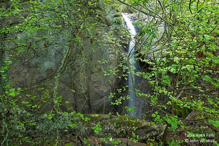
Table Rock Creek
- waterfall at (37.901750, -122.632359):
Name: Table Rock Falls
just the vertical part taken 2017-05-21:
Video:
I'll get a decent photo someday. Until then, see John Wall's photo (see below for his site)
Beauty: 6.5
Beauty: 9 (including beauty of the hike to the falls)
Duration: 365 days after a significant rainfall
Height 37 feet (broadly defined)
Height 23 feet give or take 3 feet
Biggest vertical drop 16 feet
Terrain: unofficial trail, frequently used
For more info, see:
http://jwallphoto.blogspot.com/2014/03/matt-davis-dipsea-steep-ravine-loop.html
route: It's just downstream from the well known and conspicuous Table Rock. There's a short unmarked side trail leading to the upper part of the falls; no trail yet to a view of the vertical part.
Last visited 2017-05-21
id: tam.95
Golden Gate National Recreation Area
Morses Gulch Creek
- waterfall at (37.92283, -122.66334):
Name: Morses Gulch Falls
taken 2012-04-04:
 taken 2011-04-10:
Videos:
Beauty: 8.5
Duration: 365 days after a significant rainfall
Height 48 feet (broadly defined)
Height 42 feet give or take 2 feet
Biggest vertical drop 20 feet
Terrain: unofficial trail, some difficulties
route: Follow route 1 about 2.3 miles northwest of the stop sign in the town of Stinson Beach. Park in a small dirt turnout on the right (which looks almost like the start of a dirt road) just past the 14.86 mile marker. This is about a half mile past a more conspicuous pullout at the 14.41 mile marker. You can also watch for a driveway with a sign mentioning pottery that is on the right about halfway between the two pullouts. There's a trail that starts on the north side of the creek and follows the creek a half mile to the falls.
Update: as of 2021-05-31, the trail is open, but the start is getting harder to find. Parts of the trail are well maintained. There's a section near the falls which requires holding on to a rope.
Last visited 2011-04-10
id: tam.19
Unnamed creek flowing south into Morses Gulch about a half mile upstream from route 1
- waterfall at (37.92373, -122.66291):
taken 2012-04-04:

Video:
Beauty: 8
Duration: 90 days after a significant rainfall
Height 58 feet (broadly defined)
Height 49 feet
Biggest vertical drop 20 feet
Terrain: moderate brush, little or no trail
route: From Morses Gulch Falls, go upstream a short way and go a little way up the side creek on the left. I went up the hillside just above the lower falls, but I suspect it would be easier to stay in the creekbed.
Last visited 2011-04-10
id: tam.32
back to main waterfalls page


